Gardens of Maecenas - Phase Maps:
All the maps presented here were drawn in the project:
"Die Horti des Maecenas auf dem Esquilin in Rom - eine diachrone Topographie"
("The Horti of Maecenas on the Esquiline in Rome - a diachronic topography")
and are based on the photogrammetric data of the Comune di Roma (now Roma Capitale).
C. Häuber has drawn all those maps and owns the copyright of all of them. Each map contains a tag, comprising the relevant data.
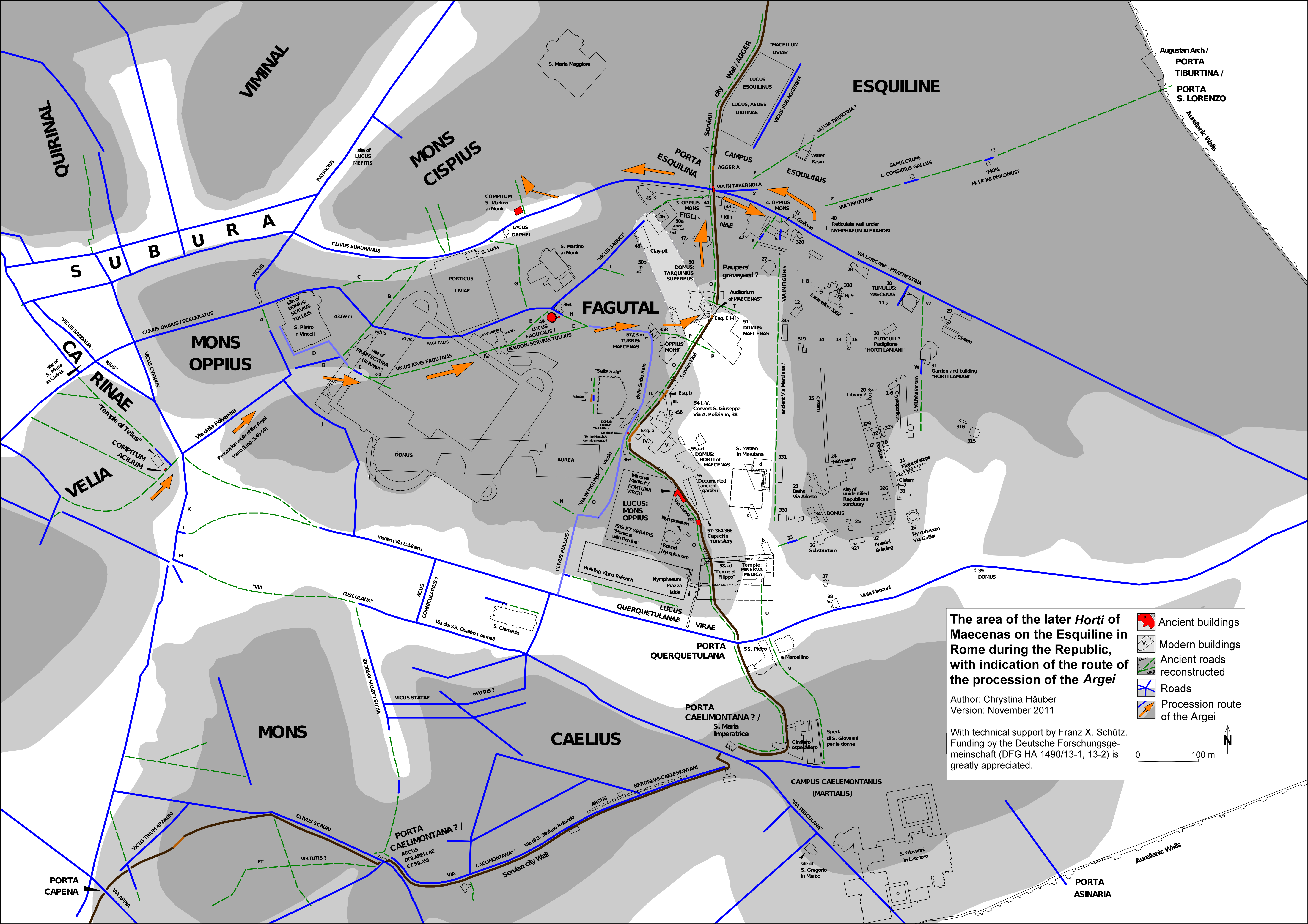
- Map 1: The area of the later Horti of Maecenas on the Esquiline Hill in Rome and their surroundings during the Republic,
with indication of the route of the procession of the Argei (see the orange arrows).
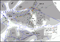
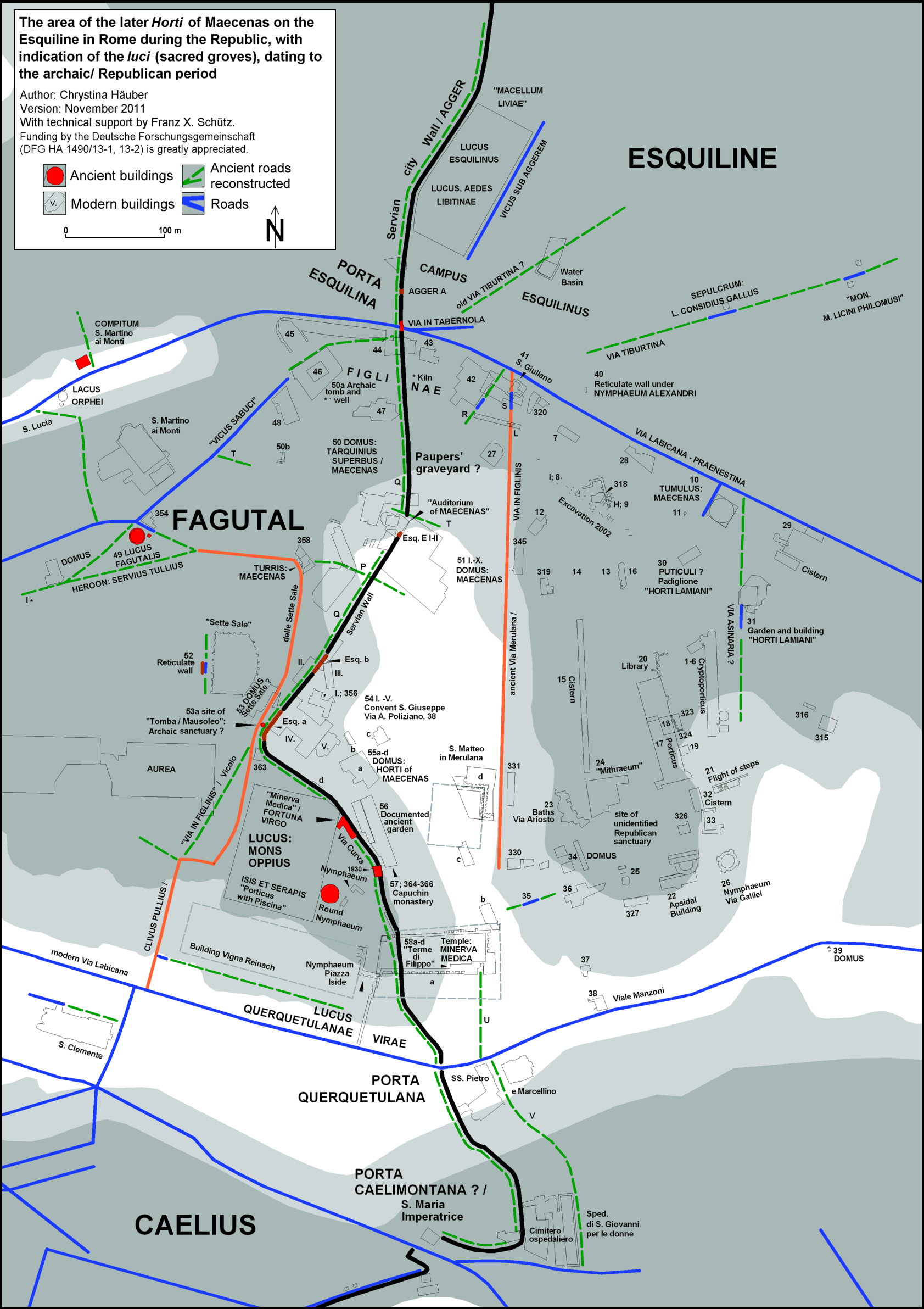
- Map 2: The area of the later Horti of Maecenas on the Esquiline Hill in Rome during the Republic, with indication of the
luci (sacred groves), dating to the archaic/ Republican period.
- Phase maps
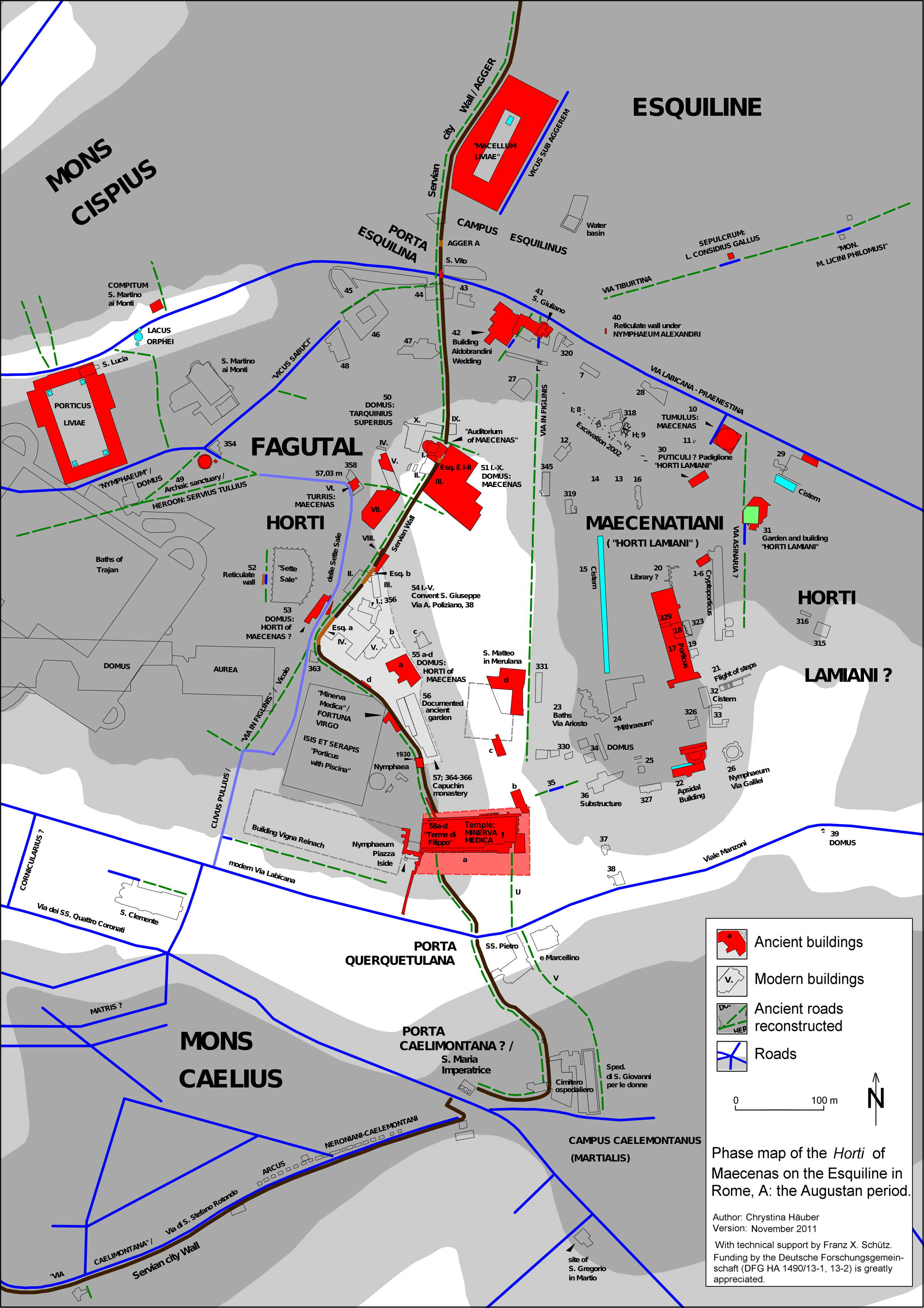
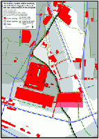
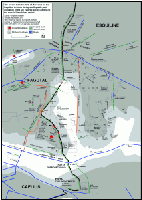
- Map 3: Phase map of the Horti of Maecenas on the Esquiline Hill in Rome, A: the Augustan period.
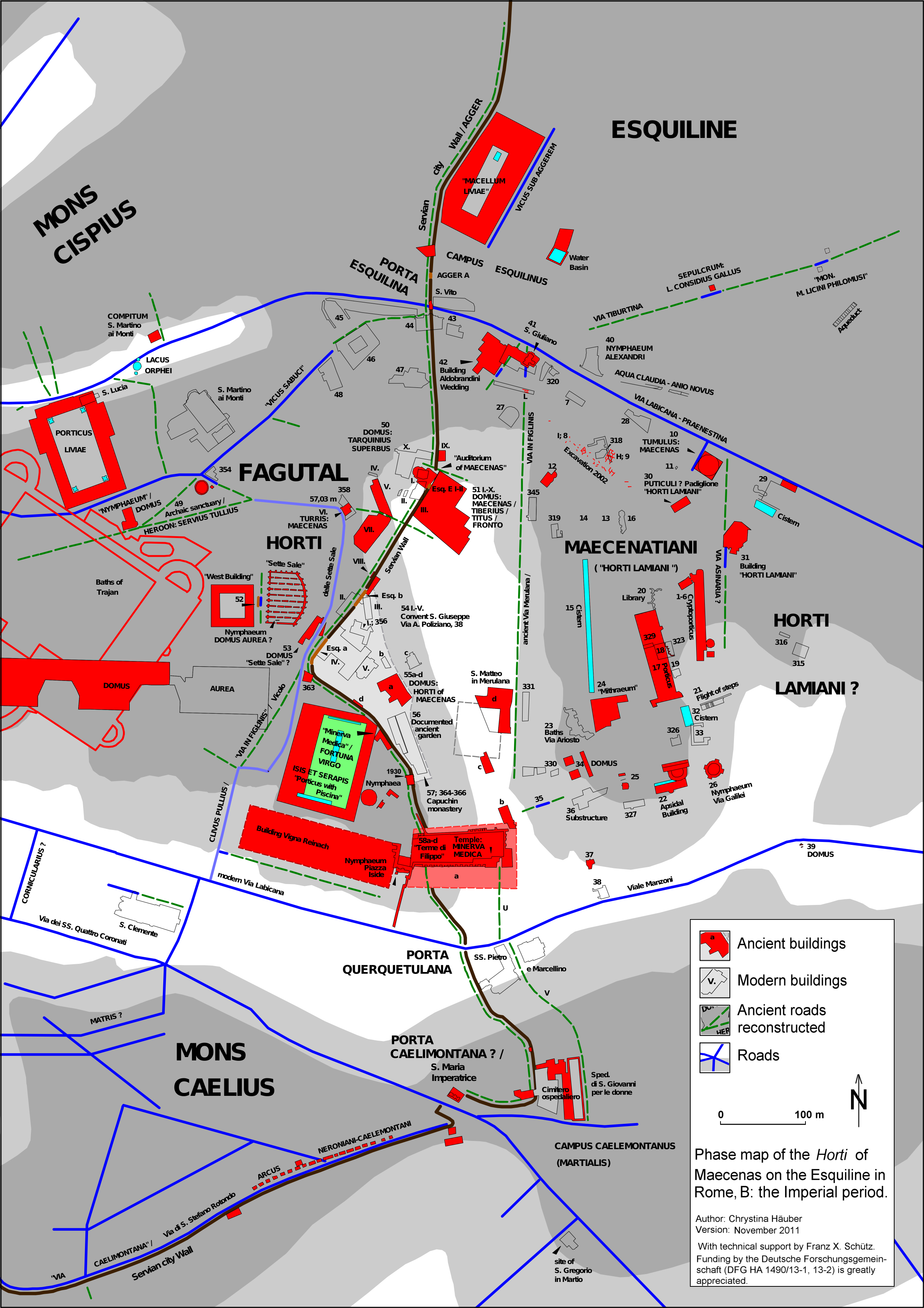
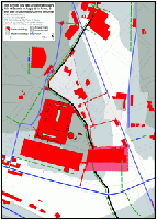
- Map 4: Phase map of the Horti of Maecenas on the Esquiline Hill in Rome, B: the Imperial period.
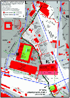
- Map 5: Phase map of the area of the former Horti of Maecenas on the Esquiline Hill in Rome, C: late antiquity.
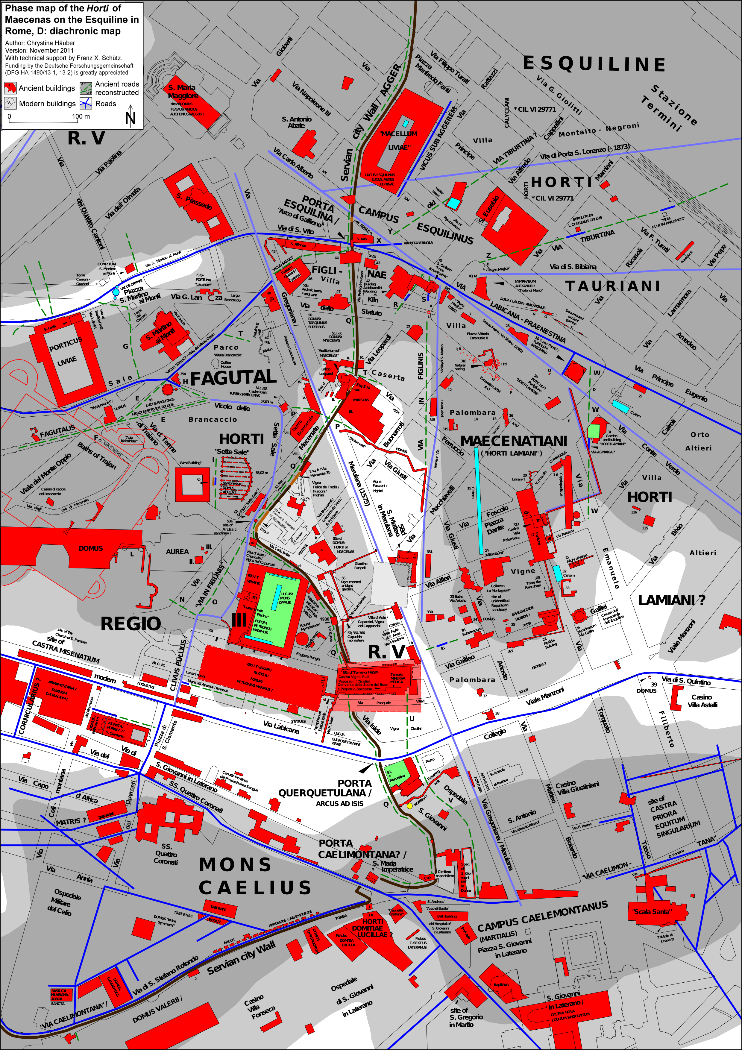
- Map 6: Phase map of the Horti of Maecenas on the Esquiline Hill in Rome, D: diachronic map, containing also those
ancient structures which cannot yet be dated, the post-antique toponymy, and the current street plan.
- Detail maps
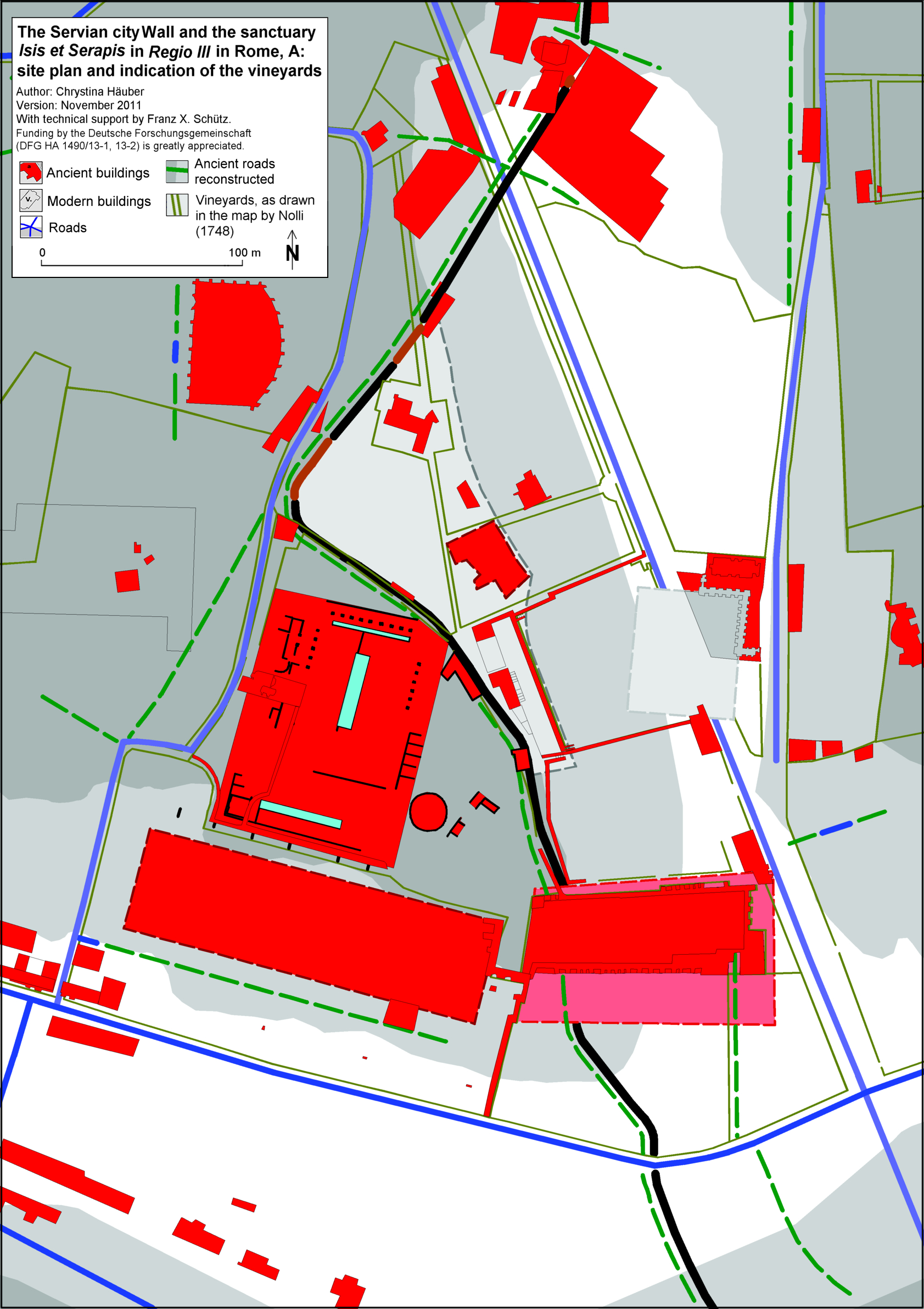
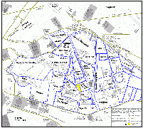
- Map 7: The Servian city Wall and the sanctuary Isis et Serapis in Regio III in Rome, A: site plan and
indication of the boundaries of the vineyards (the olive lines), as drawn in the Great Rome map by Giambattista (G. B.) Nolli (1748).
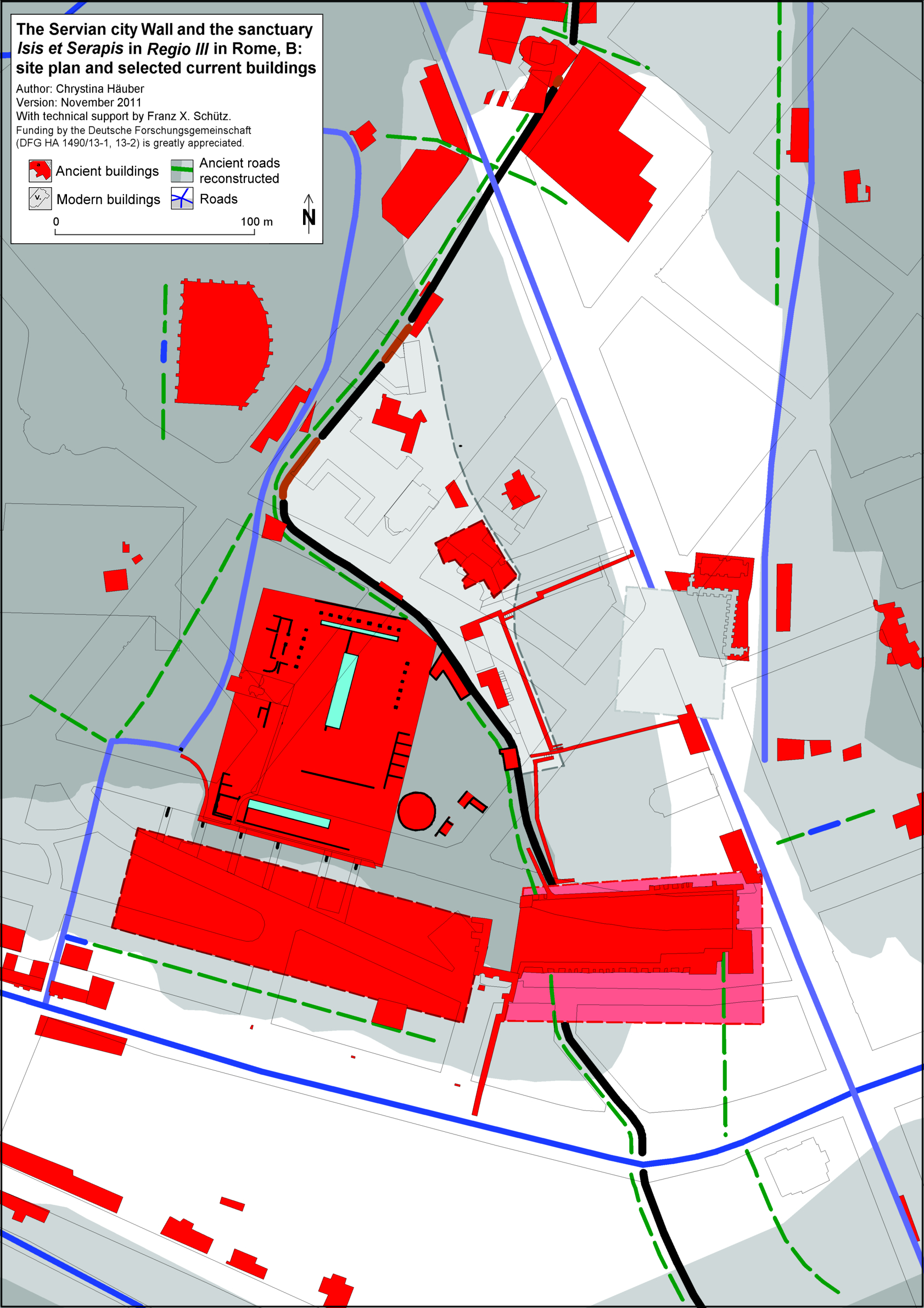
- Map 8: The Servian city Wall and the sanctuary Isis et Serapis in Regio III in Rome, B: site plan and
selected current buildings (the thin black lines), copied after the photogrammetric data of the Comune di Roma (now Roma Capitale).
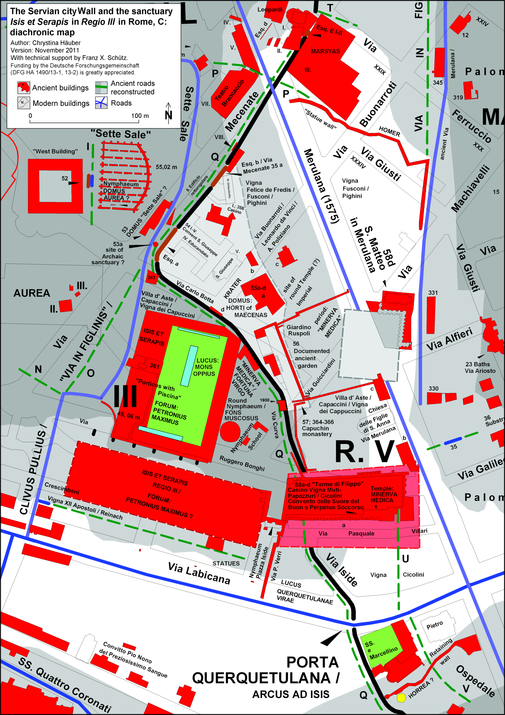
- Map 9: The Servian city Wall and the sanctuary Isis et Serapis in Regio III in Rome, C: diachronic map
(detail of Map 6), containing also the post-antique toponymy, and the current street plan.
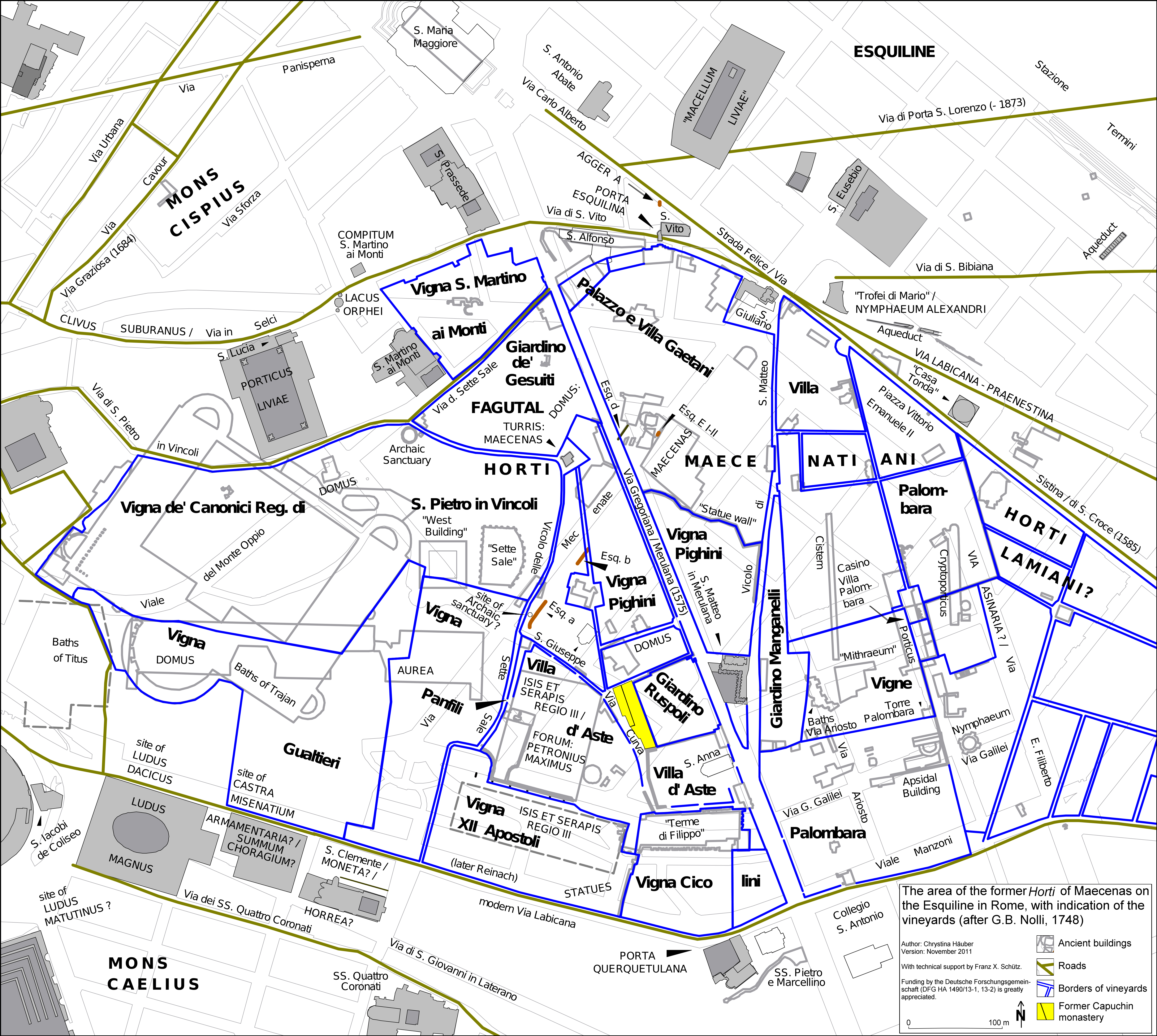
- Map 10: The area of the former Horti of Maecenas on the Esquiline Hill in Rome, with indication of the vineyards
(the dark blue lines), as drawn in the Great Rome map by Giambattista (G. B.) Nolli (1748).
Updates 11/2025:
Neueste Forschungen zu den Horti Maecenatiani online: https://fortvna-research.org/FORTVNA/FP4.html
Bibliograhie HÄUBER 2014 online: https://fortvna-research.org/texte/HAEUBER_2014_Bibliography.html
Buchvorstellung HÄUBER 2014 online: https://fortvna-research.org/haeuber/Buchvorstellung_Haeuber_2014_Rom.html
Verleihung Premio Daria Borghese für HÄUBER 2014 online: https://fortvna-research.org/haeuber/Chrystina_Haeuber_Premio_Daria_Borghese_2015.html
georeferenzierte Karten zur Topographie der Stadt Rom/ georeferenced maps of the topography of ancient Rome
Publikationen auf diesem WebServer / index of publications on this webserver
Datenschutzerklärung | Impressum