FORTVNA PAPERS 3, Fig. 66.5, Campus Martius
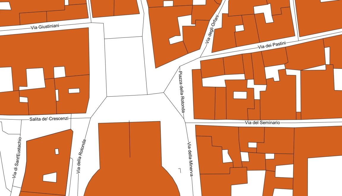
Fig. 66.5.
Map of the area, where R. Lanciani has documented the find of his
porticus (cf. here Fig. 66.4).
This map shows `the junction of the "Piazza della Rotonda"
(the square in front of the Pantheon) with the "Via dei
Pastini"´ - as Lanciani referred to the findspot of the
here-so-called `Lanciani's porticus´ (cf. R. LANCIANI, NSc
1881, 270; 1883a, 15) - and, in addition to this, the "Via degli
Orfani".
To illustrate Lanciani's explicit descriptions (NSc 1881, 270; BullCom 1883a, 15) of the precise location of his porticus, which he himself
documented on a plan (cf. id. BullCom
1883a, Tav. I-II) and on his map (FUR, fol. 15; cf. for both here Fig. 66.4), we have ourselves created the map discussed here. This map shows `the
junction of the "Piazza della Rotonda" (the square in front
of the Pantheon) with the "Via dei Pastini"´ - as Lanciani
(NSc 1881, 270) referred to the findspot of his porticus, and, in addition
to this, the "Via degli Orfani". We used for this map the
official OSM (Open Street Map), layers: buildings and streets.
Our resulting map, with the letterings "Piazza della Rotonda",
"Via dei Pastini" and "Via degli Orfani", shows
that the `square in front of the Pantheon, called "Piazza della
Rotonda"´ actually reaches as far north-east as to the junction
of the two roads "Via degli Orfani" and "Via dei
Pastini". This means that Lanciani, also with his note NSc
1879, 14 must have referred to his porticus. F.X. Schütz and C.
Häuber "AIS ROMA", reconstruction 2023.
zurück zur Hauptseite FORTVNA PAPERS 3
Go to main page: https://fortvna-research.org/Digitale_Topographie_der_Stadt_Rom/
Datenschutzerklärung | Impressum