Publikationen auf diesem WebServer / index of publications on this webserver
seit 1994 - über 30 Jahre Zusammenarbeit von Chrystina und Franz Xaver
Chrystina _ Franz Xaver
FORTVNA PAPERS
![]()
FORTVNA PAPERS II: Chrystina Häuber, Augustus and the Campus Martius in Rome: the Emperor's Rôle as
Pharaoh of Egypt and Julius Caesar's Calendar Reform; the Montecitorio Obelisk, the Meridian Line, the Ara Pacis, and the Mausoleum Augusti in Honour of
Eugenio La Rocca on the Occasion of His 70th Birthday

FORTVNA PAPERS III-1: Chrystina Häuber,The Cancelleria Reliefs and Domitian's Obelisk in Rome in context
of the legitimation of Domitian's reign. With studies on Domitian's building projects in Rome, his statue of Iuppiter Optimus Maximus Capitolinus, the colossal
portrait of Hadrian (now Constantine the Great), and Hadrian's portrait from Hierapydna in Honour of Rose Mary Sheldon
Chrystina Häuber wurde am 23.05.2015 mit dem Literaturpreis LI. Premio Daria Borghese für folgendes Buch ausgezeichnet:
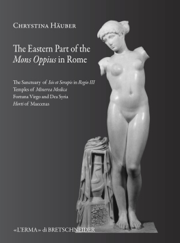
The Eastern Part of the Mons Oppius in Rome: the Sanctuary of Isis et Serapis in Regio III, the Temples of Minerva Medica, Fortuna Virgo and Dea Syria, and the Horti of Maecenas (Bullettino della Commissione Archeologica Comunale di Roma, BullCom. Supplementi, 22, 2014; L'ERMA di BRETSCHNEIDER; Roma; XXXII, 945 p. + 1 CD-ROM; ISBN: 978-88-913-0492-6)
In Druckvorbereitung:
FORTVNA PAPERS I: Franz Xaver Schütz: Visualisierung anthropogenetischer Geomorphologie in urbanen Räumen
am Beispiel der Stadt Rom. Mit einem Beitrag von Daniel Scherer
FORTVNA PAPERS IV: Chrystina Häuber: Die Laokoongruppe im Vatikan - drei Männer und zwei Schlangen:
`Ich weiß gar nicht, warum die sich so aufregen´ (Wolfgang Böhme) - die Bestätigung von F. Magis Restaurierung der Gruppe und der Behauptungen, sie sei für die
Horti des Maecenas, später Domus Titi, geschaffen, und dort entdeckt worden.
Laufende Forschungsprojekte
AIS ROMA (seit 2003)
mit den Teilprojekten:
Horti Sallustiani - seit 2012 (Rekonstruktion und Visualisierung der "Horti Sallustiani" in Rom - eine digitale und diachrone Topographie)
Die augusteische Regio XIV Transtiberim in Rom. Eine digitale und diachrone Topographie (seit 2015)
Versuch einer Rekonstruktion der anthropogenetischen Geomorphologie der Stadt Rom (seit 2022)
Abgeschlossene Forschungsprojekte
"Die Horti des Maecenas auf dem Esquilin in Rom - eine diachrone Topographie" (2009-2011)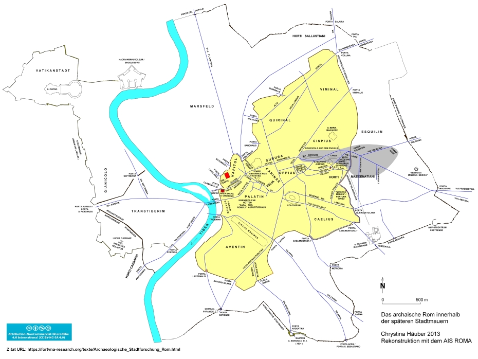
Abbildung: Digitale Topographie der Stadt Rom mit dem kompletten Untersuchungsgebiet
(aus: Archäologische Stadtforschung)
Publikationen auf diesem WebServer / index of publications on this webserver
