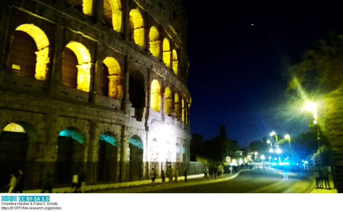
zu unseren Seiten zur digitalen Topographie und Geschichte der Stadt Rom /
to our pages on the digital topography and history of the city of Rome /
alle nostre pagine sulla topografia digitale e la storia della città di Roma
Chrystina Häuber und Franz Xaver Schütz - ( seit 1994 )
 ....
....
 ....
....
 ....
....
 ....
....
 ....
....
 ....
....
 ....
....
 ....
....
neu/new:
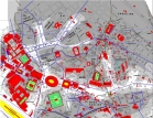
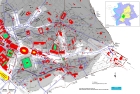
georeferenzierte Karten zur Topographie der Stadt Rom / georeferenced maps of the topography of ancient Rome /
mappe e piani georeferenziate della topografia dell'antica Roma
Publikationen auf diesem WebServer / index of publications on this webserver
Chrystina _ Franz Xaver
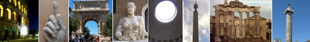
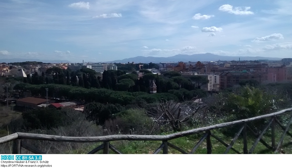
eigene kostenlose und freie Fotos/Bilder aus Rom / free images from Rome
FORTVNA PAPERS II: Chrystina Häuber,
Augustus and the Campus Martius in Rome: the Emperor's Rôle as Pharaoh of Egypt and Julius Caesar's Calendar Reform; the Montecitorio Obelisk, the Meridian Line,
the Ara Pacis, and the Mausoleum Augusti in Honour of Eugenio La Rocca on the Occasion of His 70th Birthday
FORTVNA PAPERS III-1: Chrystina Häuber,The Cancelleria Reliefs and Domitian's Obelisk in Rome in context
of the legitimation of Domitian's reign. With studies on Domitian's building projects in Rome, his statue of Iuppiter Optimus Maximus Capitolinus, the colossal
portrait of Hadrian (now Constantine the Great), and Hadrian's portrait from Hierapydna in Honour of Rose Mary Sheldon
Datenschutzerklärung | Impressum
Digitale Topographie der Stadt Rom , freie wissenschaftliche Texte, Karten, Photos, Geographie , Archäologie , Geschichte, Latein
von Dr. Chrystina Häuber und Dr. Franz Xaver Schütz
Pessinus Rom Kybele - neue Forschungen 2026
......
Schnee in Rom im Schnee
......
 Chrystina HÄUBER (2026): Der Kulttransfer der Göttin Mater Deum Magna Idaea/ Kybele aus Pessinus nach Rom (205/204 v. Chr.). Neue Forschungen.
Zum augusteischen Marmorrelief im Pergamonmuseum Berlin (Inv. Sk 955) vom Esquilin in Rom, aus den Horti des Maecenas ? Mit einem Beitrag von Franz Xaver Schütz
......
Chrystina HÄUBER (2026): Zur Lage der Porta Caelimontana und des Campus Caelemontanus in Abhängigkeit vom Verlauf der Servianischen Stadtmauer auf dem Oppius und Caelius
......
Chrystina HÄUBER (2026): MATER MAGNA (Quellen zum Relief Sk 955 im Pergamonmuseum; hier Abb. 1; Taf. 53-55)
......
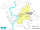
mappe georeferenziate della topografia e della storia della città di Roma / georeferenzierte Karten zur Topographie und Geschichte der Stadt Rom /
georeferenced maps of the coty of Rome on topography and history / ローマ市の地形と歴史のジオリファレンスされた地図 / Franz Xaver Schütz, Chrystina Häuber
......
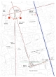
Servianische Stadtmauer Rom Via di S. Anselmo
......
Der Aufbruch der Göttin Kybele in Pessinus ? Zu einem römischen Marmorrelief im Pergamonmuseum Berlin
......
CIRCUS MAXIMUS Photos und Karte......
Sette Sale - Esquilin - Rom - antiker Wasserspeicher......
Universtität Tübingen - Sommersemester 2010 - Römische Archäologie I - Republik
(Vorlesungen von Chrystina Häuber)......
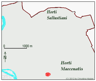
Bibliographie Horti Sallustiani......
V O R S C H A U / P R E V I E W , Chrystina Häuber (in Druckvorbereitung) ,
Die Laokoongruppe im Vatikan - drei Männer und zwei Schlangen: `Ich weiß gar nicht, warum die sich so aufregen´ (Wolfgang Böhme) - die Bestätigung von
F. Magis Restaurierung der Gruppe und der Behauptungen, sie sei für die Horti des Maecenas, später Domus Titi, geschaffen, und dort entdeckt worden ,
FORTVNA PAPERS Volume IV, edited by Franz Xaver Schütz and Chrystina Häuber, in Druckvorbereitung, (München: Hochschule München). ......
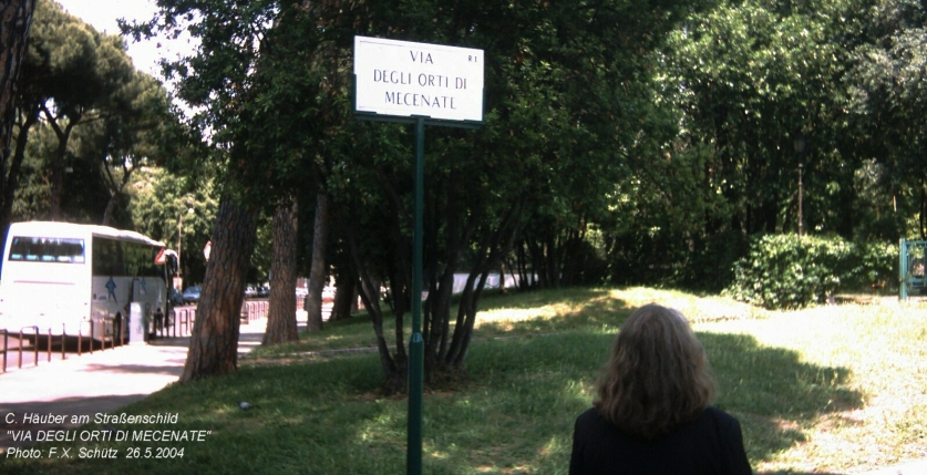
Maecenas, seine Horti in Rom, und seine Laokoongruppe
(die sich in den Vatikanischen Museen befindet; hier Dia 5). Neue Forschungen.......
endlich lebe ich wie ein Mensch - Zu domus, horti und villae in Rom......
Horti Mecenate Livia Field-Brancaccio Rome......
Horti Mecenate Livia Field-Brancaccio ROMA......
The Analysis of Persistent Structures: A Functionality of the Archaeological
Information System FORTVNA.......
Horti Maecenas Livia Field-Brancaccio......
Literatur Laokoon......
Laudatio di Chrystina Häuber, 23 maggio 2015 (Laudatio auf Chrystina Häuber,
23. Mai 2015)......
"Minerva Medica"......
Persistenz - Geographie......
Ägyptischer Obelisk , Obelisco Dogali , Rom
......
Tempel Römische Republik Largo Torre Argentina Rom
......
Beitrag von Daniel Scherer: Using ZODB to store and query
geospatial data with python [in FORTVNA PAPERS I , preview vom 19.2.2025 - pp. 225-231
......
Chrystina HÄUBER (2025): Neues zum Koloss Konstantins des Großen im Konservatorenpalast in Rom, der aus einem Hadrianportrait umgearbeitet worden ist
......
Via tecta - Porticus - Forum Holitorium - Rom
......
Karte und Bilder Obelisco Macuteo Rom
......
Karte und Bilder Basilica Paulli Rom
......
Porta Triumphalis Rom Kaiserzeit
......
Karte und Bilder Curia Julia Rom
......
Karte und Bilder Trajansmärkte in Rom
Chrystina HÄUBER (2026): Der Kulttransfer der Göttin Mater Deum Magna Idaea/ Kybele aus Pessinus nach Rom (205/204 v. Chr.). Neue Forschungen.
Zum augusteischen Marmorrelief im Pergamonmuseum Berlin (Inv. Sk 955) vom Esquilin in Rom, aus den Horti des Maecenas ? Mit einem Beitrag von Franz Xaver Schütz
......
Chrystina HÄUBER (2026): Zur Lage der Porta Caelimontana und des Campus Caelemontanus in Abhängigkeit vom Verlauf der Servianischen Stadtmauer auf dem Oppius und Caelius
......
Chrystina HÄUBER (2026): MATER MAGNA (Quellen zum Relief Sk 955 im Pergamonmuseum; hier Abb. 1; Taf. 53-55)
......
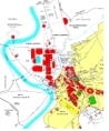
mappe georeferenziate della topografia e della storia della città di Roma / georeferenzierte Karten zur Topographie und Geschichte der Stadt Rom /
georeferenced maps of the coty of Rome on topography and history / ローマ市の地形と歴史のジオリファレンスされた地図 / Franz Xaver Schütz, Chrystina Häuber
......
Servianische Stadtmauer Rom Via di S. Anselmo
......
Der Aufbruch der Göttin Kybele in Pessinus ? Zu einem römischen Marmorrelief im Pergamonmuseum Berlin
......
CIRCUS MAXIMUS Photos und Karte......
Sette Sale - Esquilin - Rom - antiker Wasserspeicher......
Universtität Tübingen - Sommersemester 2010 - Römische Archäologie I - Republik
(Vorlesungen von Chrystina Häuber)......
Bibliographie Horti Sallustiani......
V O R S C H A U / P R E V I E W , Chrystina Häuber (in Druckvorbereitung) ,
Die Laokoongruppe im Vatikan - drei Männer und zwei Schlangen: `Ich weiß gar nicht, warum die sich so aufregen´ (Wolfgang Böhme) - die Bestätigung von
F. Magis Restaurierung der Gruppe und der Behauptungen, sie sei für die Horti des Maecenas, später Domus Titi, geschaffen, und dort entdeckt worden ,
FORTVNA PAPERS Volume IV, edited by Franz Xaver Schütz and Chrystina Häuber, in Druckvorbereitung, (München: Hochschule München). ......
Maecenas, seine Horti in Rom, und seine Laokoongruppe
(die sich in den Vatikanischen Museen befindet; hier Dia 5). Neue Forschungen.......
endlich lebe ich wie ein Mensch - Zu domus, horti und villae in Rom......
Horti Mecenate Livia Field-Brancaccio Rome......
Horti Mecenate Livia Field-Brancaccio ROMA......
The Analysis of Persistent Structures: A Functionality of the Archaeological
Information System FORTVNA.......
Horti Maecenas Livia Field-Brancaccio......
Literatur Laokoon......
Laudatio di Chrystina Häuber, 23 maggio 2015 (Laudatio auf Chrystina Häuber,
23. Mai 2015)......
"Minerva Medica"......
Persistenz - Geographie......
Ägyptischer Obelisk , Obelisco Dogali , Rom
......
Tempel Römische Republik Largo Torre Argentina Rom
......
Beitrag von Daniel Scherer: Using ZODB to store and query
geospatial data with python [in FORTVNA PAPERS I , preview vom 19.2.2025 - pp. 225-231
......
Chrystina HÄUBER (2025): Neues zum Koloss Konstantins des Großen im Konservatorenpalast in Rom, der aus einem Hadrianportrait umgearbeitet worden ist
......
Via tecta - Porticus - Forum Holitorium - Rom
......
Karte und Bilder Obelisco Macuteo Rom
......
Karte und Bilder Basilica Paulli Rom
......
Porta Triumphalis Rom Kaiserzeit
......
Karte und Bilder Curia Julia Rom
......
Karte und Bilder Trajansmärkte in Rom
Karte und Bilder Cloaka Maxima in Rom
Ehrenstatue für Hadrian in Rom - Hierapydna
Chrystina HÄUBER (2024): Der Fundort der Laokoongruppe und die domus Titi imperatoris (Plin. nat. 36,37-38).
Chrystina HÄUBER (2024): Horti in flavischer Zeit - mit 3 Karten.
(Das deutsche Manuskript des Artikels "Gli horti in età flavia", 2009).
Chrystina HÄUBER (2024): Horti Sallustiani in Rom - neue Erkenntnisse.
Ehrenstatue für Hadrian in Rom
Bilder Septimius Severus Bogen
Bilder Konstantinsbogen
Bilder Tempel Faustina und Antoninus Pius
Bilder Saturntempel
Bilder Tempel Apollo Sosianus
Bilder Marcellustheater
Bilder Tempel des Portunus
Konstantin, Hadrian, Koloss, Hadrianeum, Rom, Kapitel 1
Konstantin, Hadrian, Koloss, Hadrianeum, Rom, Kapitel 2
Konstantin, Hadrian, Koloss, Hadrianeum, Rom, Kapitel 3
Konstantin, Hadrian, Koloss, Hadrianeum, Rom, Kapitel 4
Konstantin, Hadrian, Koloss, Hadrianeum, Rom, Kapitel 5
Konstantin, Hadrian, Koloss, Hadrianeum, Rom, Kapitel 6
Konstantin, Hadrian, Koloss, Hadrianeum, Rom, Kapitel 7
Konstantin, Hadrian, Koloss, Hadrianeum, Rom, Kapitel 8
Konstantin, Hadrian, Koloss, Hadrianeum, Rom, Kapitel 9
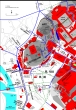
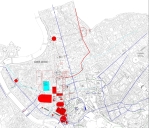
Romkarten
Horti Sallustiani - neue Erkenntnisse
Horti Sallustiani - Photos
FORTVNA PAPERS online 2-2024 , Der Persistenzindex (PX) in der Geographie
Bedeutung, Definition, Anwendung
metrologische Analysen im Stadtgrundriss/Stadtplan - Geographie
Persistenzindex - Geographie
Persistenz - Geographie
FORTVNA PAPERS 3 - BIBLIOGRAPHY -
part 1: A-C --
part 2: D-H --
part 3: I-P --
part 4: Q-Z
Arco di Portogallo in Rom
Wie schwer war der ägyptische Obelisk, der heute auf der Piazza di S. Giovanni in Laterano in Rom steht? von Franz Xaver Schütz
Chrystina Häuber -Die Horti des Maecenas auf dem Esquilin in Rom - eine diachrone Topographie
Bilder aus der Zeit an der LMU (2010-2021)
Chrystina Häuber, Symposium 2012 mit Professor Coarelli
Chrystina Häuber, Kapitol, Rom
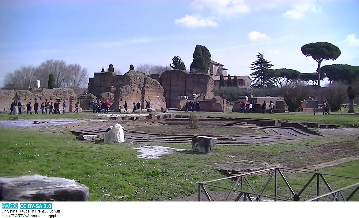
Chrystina Häuber, Audotorium des Maecenas, Rom
Franz Xaver Schütz (2023): Zur kartographischen Visualisierung historischer Landschaftselemente
zwischen Rhein und Schwarzem Meer von Augustus bis Hadrian
Chrys bei der Entwicklung Archäologischer Informationssysteme (AIS)
Chrys am Museum Ludwig
Chrys in Rom
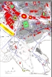
Georeferenzierte Karte Rom, Marsfeld und Umgebung (CAMPUS MARTIUS) 2022
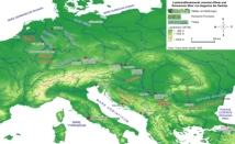
Text und georeferenzierte Karte Landschaftselemente zwischen Rhein und Schwarzem Meer, Franz Xaver Schütz
"Exkursion Donaumoos" im Sommersemester 2003 (Franz Xaver Schütz, Diplom-Geograph) -->
Texte zur Exkursion
 Reconstruction and Visualization of the "Horti Sallustiani" in Rome - a digital and diachronic topography (Rekonstruktion und Visualisierung
der "Horti Sallustiani" in Rom - eine digitale und diachrone Topographie)
Reconstruction and Visualization of the "Horti Sallustiani" in Rome - a digital and diachronic topography (Rekonstruktion und Visualisierung
der "Horti Sallustiani" in Rom - eine digitale und diachrone Topographie)
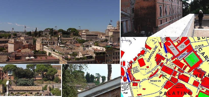 --- Palatin - Rom - Blick zum Kapitol - "DOMUS TIBERIANA"
 --- "Le Colonnacce", Rom, Forum des Domitian, des Nerva, FORUM TRANSITORIUM, PIROUSTAE
 --- Palatin - Rom - Palast des Domitian - "DOMUS FLAVIA"/DOMUS AUGUSTANA - "Peristyl" mit Labyrinth-Brunnen
Madama Lucrezia - Photos und Karten (FORTVNA PAPERS Online 1-2023)
 --- Colosseum - AMPHITHEATRUM
 Chrystina Häuber erhält Premio Daria Borghese 2015 in Rom für ihr Buch The Eastern Part of the Mons Oppius in Rome.
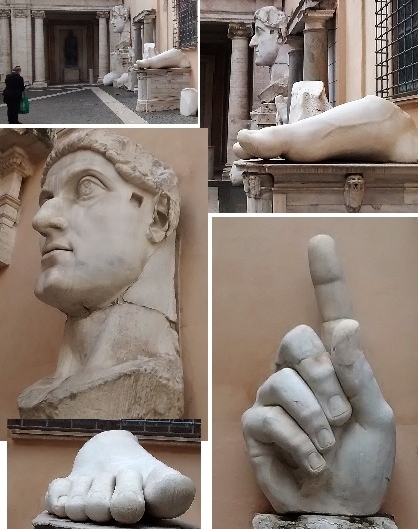 Fragmente Kolossalstatue Hadrian, umgearbeiteter Kopf Konstantin der Große, Photos by Chrystina Häuber, Franz Xaver Schütz
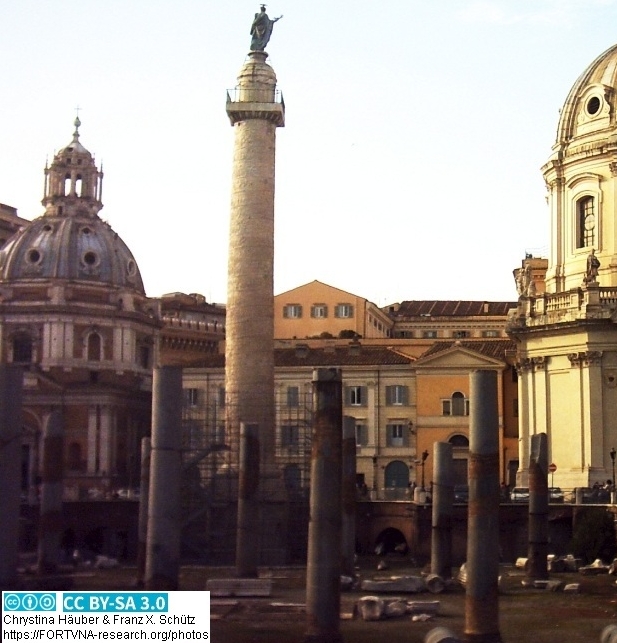
--- --- Trajanssäule / Column of Trajan in Rom
--- SEPULCRUM: C. PUBLICIUS BIBULUS - Grab des Gaius Publicius Bibulus in Rom
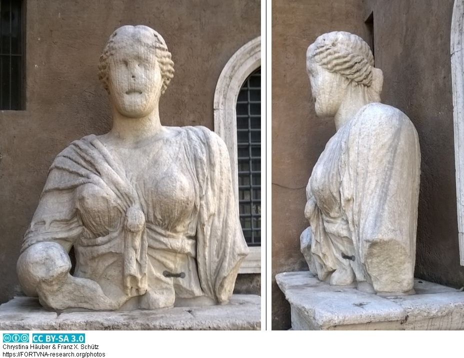 --- "Madama Lucrezia" - kolossale ISIS-Statue aus Marmor, photos by Chrystina Häuber, Franz Xaver Schütz
Franz Xaver Schütz
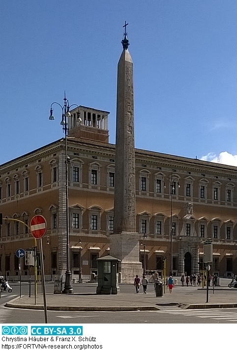 --- Piazza di S. Giovanni in Laterano - Ägyptischer Obelisk,
photos by Chrystina Häuber, Franz Xaver Schütz
--- Piazza di S. Giovanni in Laterano - Ägyptischer Obelisk,
photos by Chrystina Häuber, Franz Xaver Schütz
 --- Auditorium des MAECENAS, photos by Chrystina Häuber, Franz Xaver Schütz
Texte auf der Romkarte aus Archäologische Stadtforschung 2013 / texts on the map of ancient Rome from archaeological urban research 2013
 --- PORTA ESQUILINA, photos by Chrystina Häuber, Franz Xaver Schütz
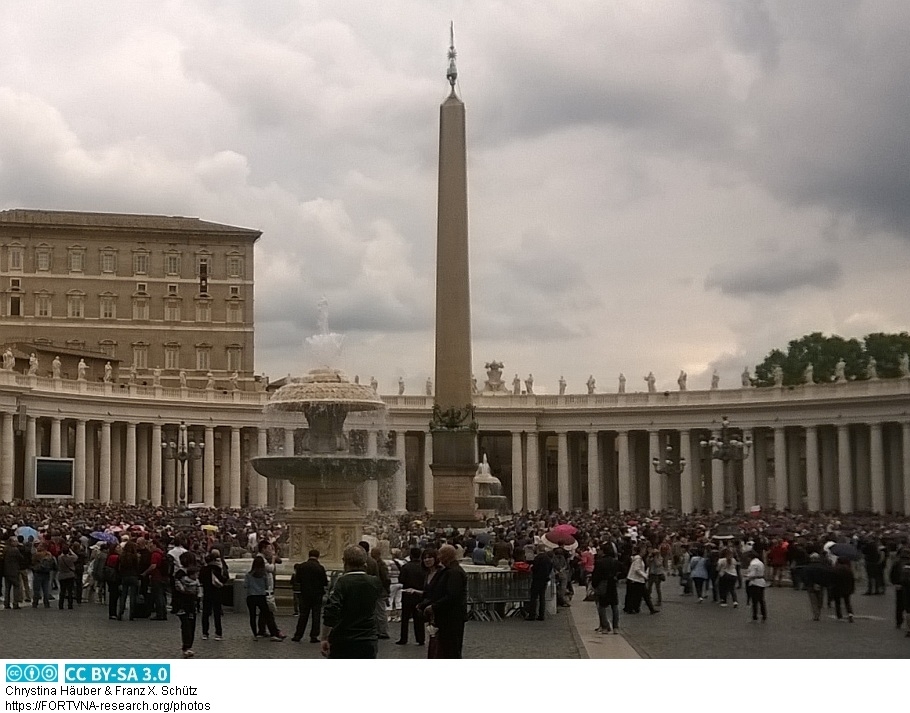 --- Vatikan Obelisk, Piazza di San Pietro, photos by Chrystina Häuber, Franz Xaver Schütz
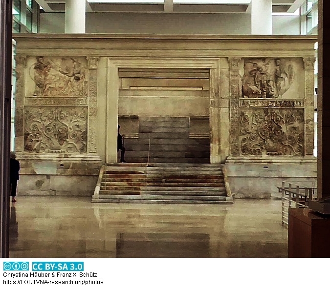 --- ARA PACIS AUGUSTAE, photos by Chrystina Häuber, Franz Xaver Schütz
 --- Esquilin Obelisk, photos by Chrystina Häuber, Franz Xaver Schütz
 --- Quirinal Obelisk, photos by Chrystina Häuber, Franz Xaver Schütz
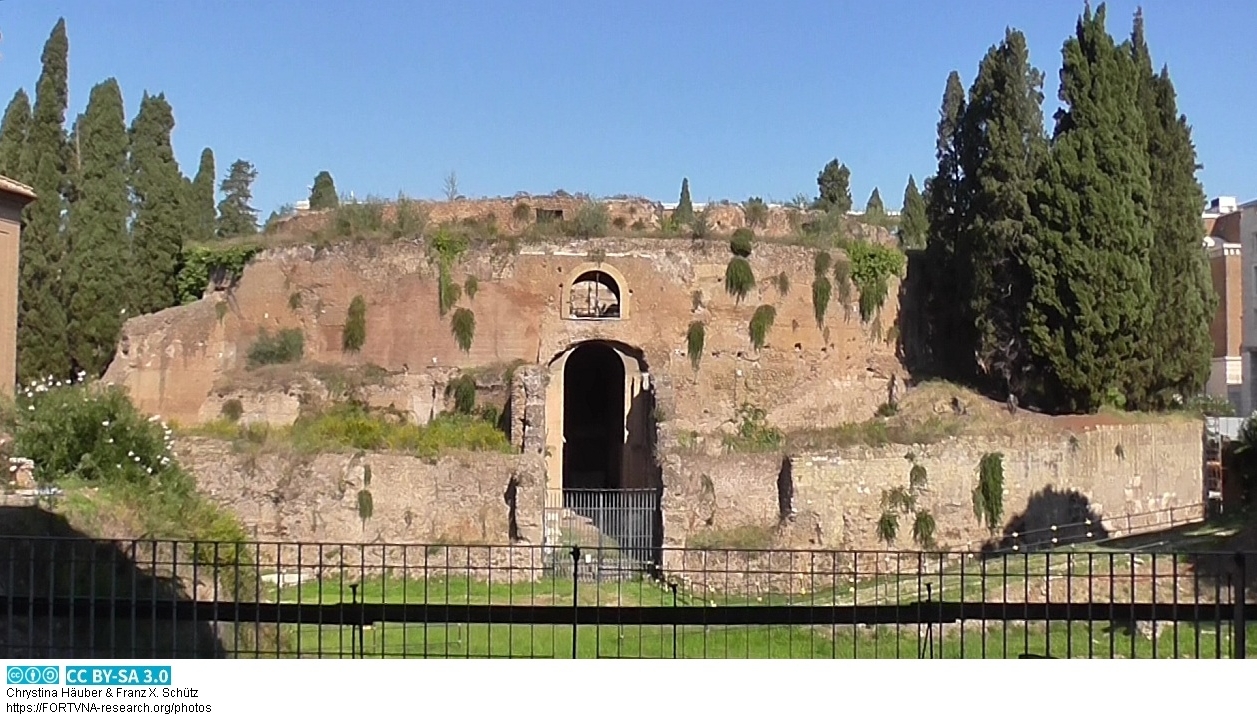 --- MAUSOLEUM AUGUSTI, Rom, photos by Chrystina Häuber, Franz Xaver Schütz
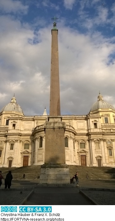
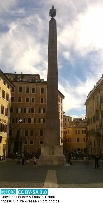 --- Montecitorio Obelisk, Rom, photos by Chrystina Häuber, Franz Xaver Schütz
II. WELL KNOWN FACTS CONCERNING THE SUBJECTS DISCUSSED HERE AND SOME NEW
OBSERVATIONS, pages 55-61 from FORTVNA PAPERS Volume 2, 2017, Chrystina Häuber: Augustus and the Campus Martius in Rom
II. WELL KNOWN FACTS CONCERNING THE SUBJECTS DISCUSSED HERE AND SOME NEW
OBSERVATIONS, pages 49-54 from FORTVNA PAPERS Volume 2, 2017, Chrystina Häuber: Augustus and the Campus Martius in Rom
")
")
")

LIST OF ILLUSTRATIONS, pages 27-32 from FORTVNA PAPERS Volume 2, 2017,
Chrystina Häuber: Augustus and the Campus Martius in Rom
ACKNOWLEDGEMENTS, pages 23-26 from FORTVNA PAPERS Volume 2, 2017,
Chrystina Häuber: Augustus and the Campus Martius in Rom
PREFACE, pages 17-22 from FORTVNA PAPERS Volume 2, 2017, Chrystina Häuber:
Augustus and the Campus Martius in Rom
I. INTRODUCTION, pages 33-48 from FORTVNA PAPERS Volume 2, 2017, Chrystina Häuber:
Augustus and the Campus Martius in Rome


================================================================================================================
Übung im Modul "GEO 44, Geoinformatik" im Sommersemester 2011, Text zur Übung vom 19.4.2011
Übung "GEO-73, Applied Geographical Information Systems", Wintersemester 2011/2012, Text zur Übung vom 26.10.2011
"Raumanalysen und regionale Planungsprozesse", Teil Schütz, Sommersemester 2020, Master Geomatik, 2. Lehrbrief vom 4.4.2020
"Raumanalysen und regionale Planungsprozesse", Teil Schütz, Sommersemester 2020, Master Geomatik, 4. Lehrbrief vom 12.5.2020
Monte Testaccio - Scherbenberg in Rom, anthropogene Geomorphologie, maps and photos by Chrystina Häuber, Franz Xaver Schütz
Monte Testaccio - Scherbenberg in Rom, anthropogene Geomorphologie, maps and photos by Chrystina Häuber, Franz Xaver Schütz
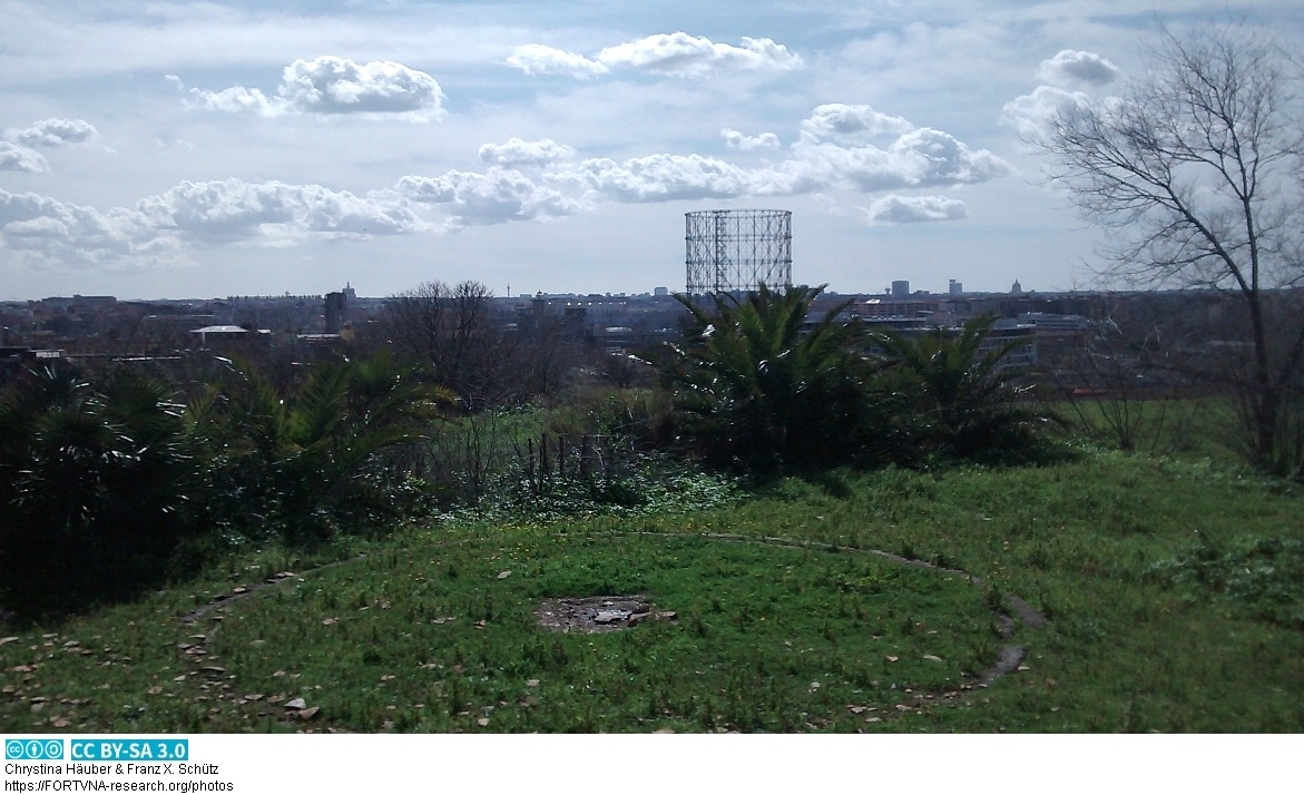
Monte Testaccio - Scherbenberg in Rom, anthropogene Geomorphologie, maps and photos by Chrystina Häuber, Franz Xaver Schütz
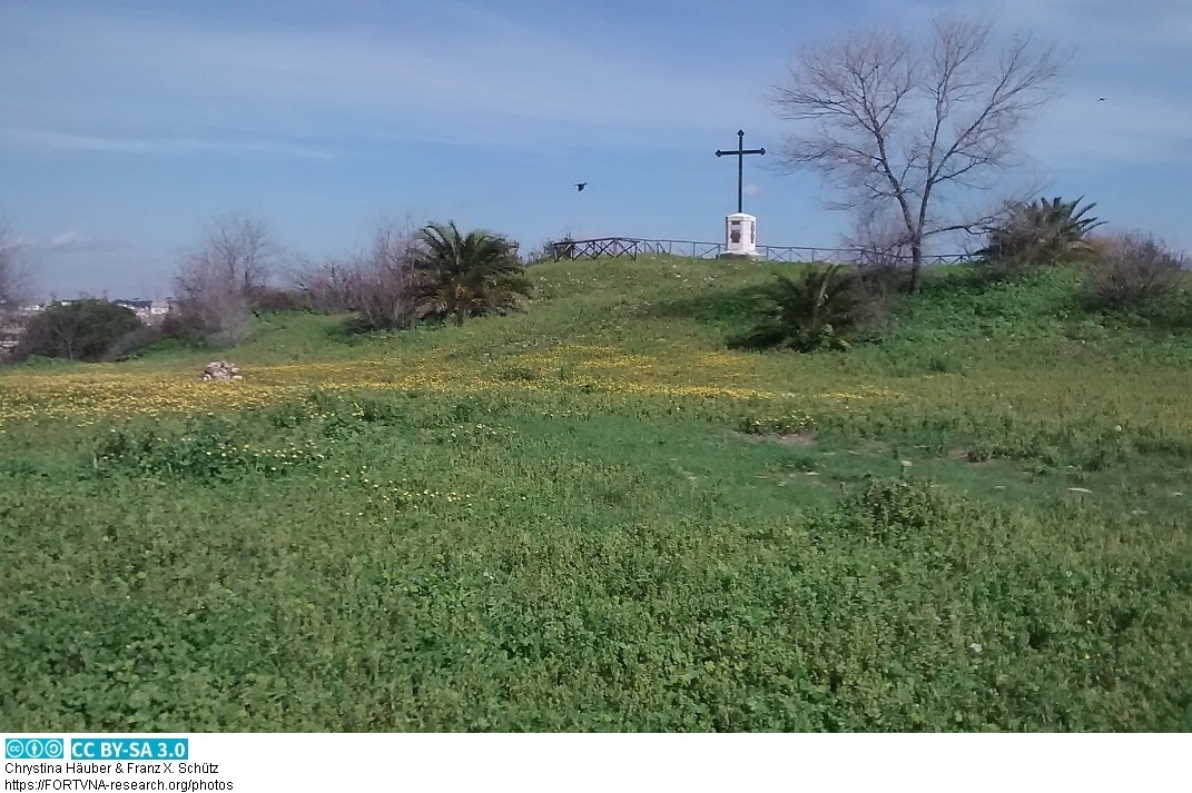
Monte Testaccio - Scherbenberg in Rom, anthropogene Geomorphologie, maps and photos by Chrystina Häuber, Franz Xaver Schütz
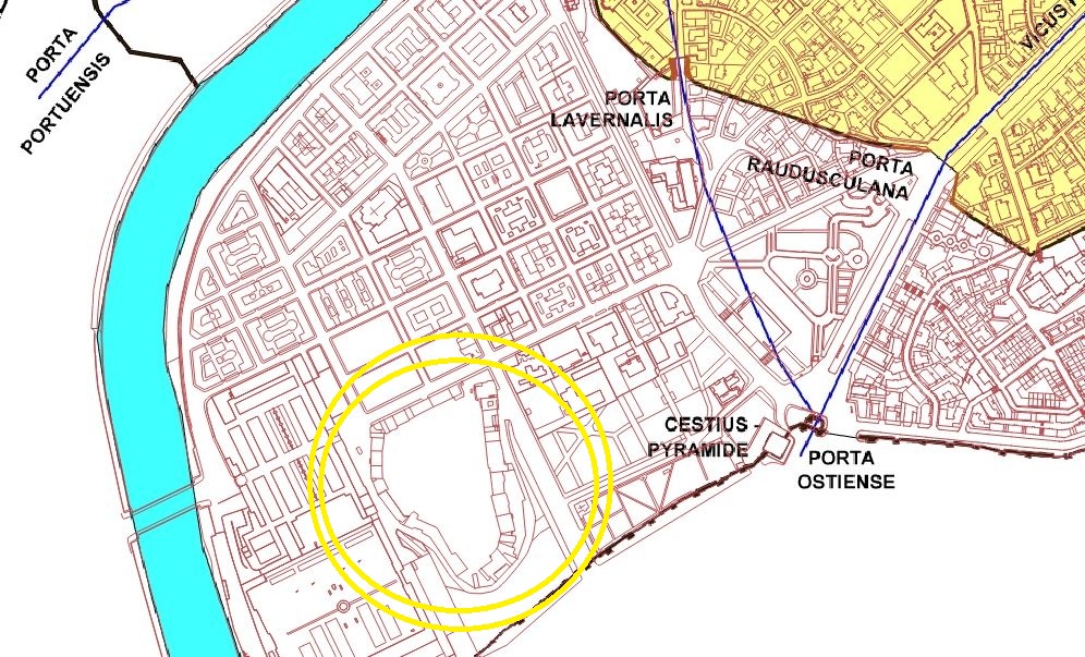
Monte Testaccio - Scherbenberg in Rom, anthropogene Geomorphologie, maps and photos by Chrystina Häuber, Franz Xaver Schütz
Monte Testaccio - Scherbenberg in Rom, anthropogene Geomorphologie, maps and photos by Chrystina Häuber, Franz Xaver Schütz

Obelicso Sallustiano - Ägyptischer Obelisk Piazza della Trinita dei Monti Rom, maps and photos by Chrystina Häuber, Franz Xaver Schütz
Obelicso Sallustiano - Ägyptischer Obelisk Piazza della Trinita dei Monti Rom, maps and photos by Chrystina Häuber, Franz Xaver Schütz
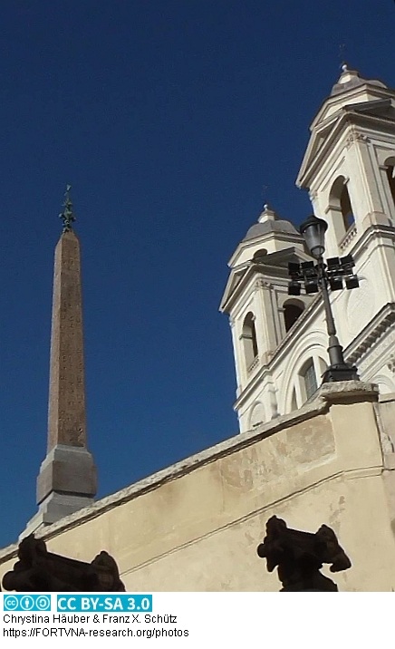
Obelicso Sallustiano - Ägyptischer Obelisk Piazza della Trinita dei Monti Rom, maps and photos by Chrystina Häuber, Franz Xaver Schütz
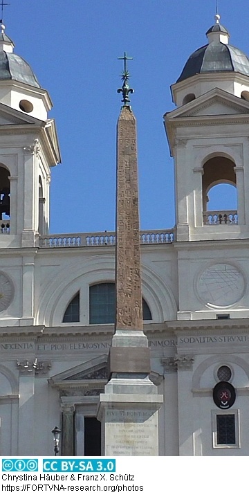
Obelicso Sallustiano - Ägyptischer Obelisk Piazza della Trinita dei Monti Rom, maps and photos by Chrystina Häuber, Franz Xaver Schütz
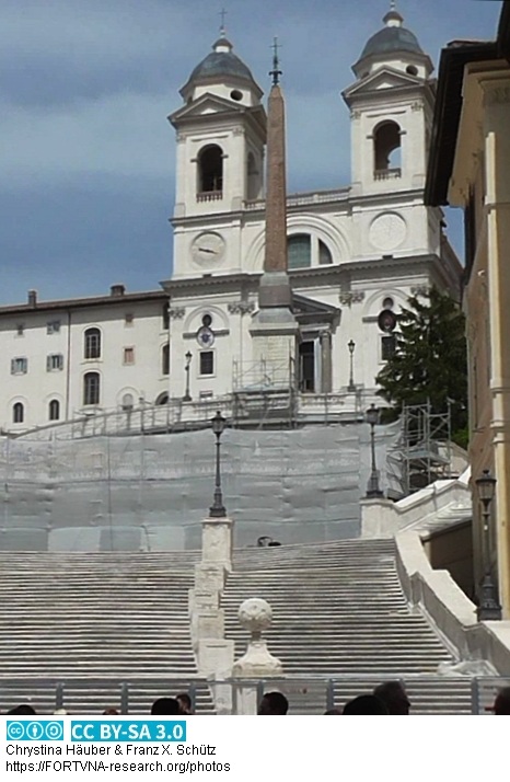
Obelicso Sallustiano - Ägyptischer Obelisk Piazza della Trinita dei Monti Rom, maps and photos by Chrystina Häuber, Franz Xaver Schütz
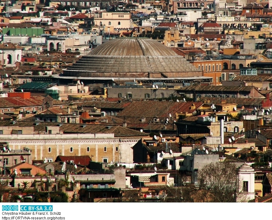
Pantheon, Rom, maps and photos by Chrystina Häuber, Franz Xaver Schütz
Pantheon, Rom, PANTHEON, ROME, Chrystina Häuber, Franz Xaver Schütz
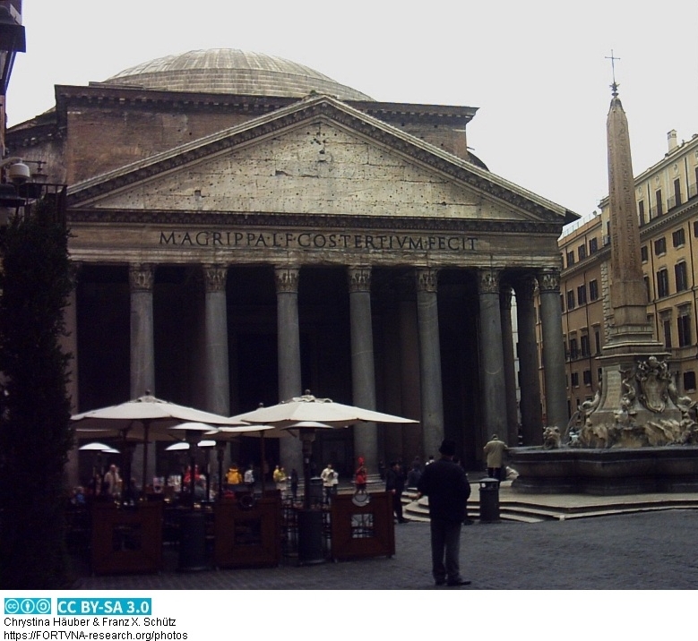
Pantheon, Rom, PANTHEON, ROME, Chrystina Häuber, Franz Xaver Schütz
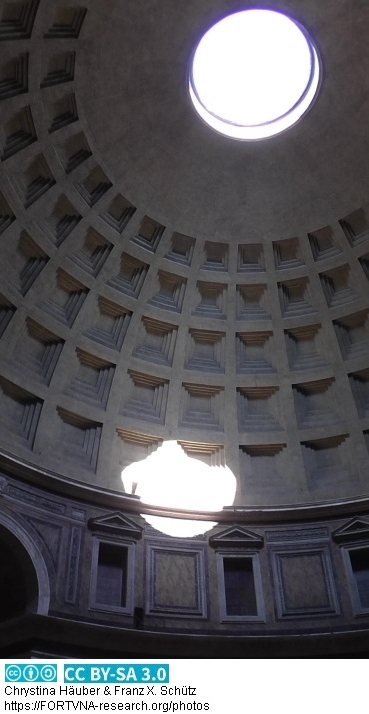
Pantheon, Rom, PANTHEON, ROME, Chrystina Häuber, Franz Xaver Schütz
Chrystina HÄUBER, Franz Xaver SCHÜTZ (1999): THE MULTI-DISCIPLINARY MULTIMEDIA GEOGRAPHICAL INFORMATION SYSTEM APPLIED TO ARCHAEOLOGY GIS[A] FORTVNA:
THE BASICS OF DEVELOPMENT. In: Proceedings of the XVth International Congress of Classical Archaeology, Amsterdam, July 12-17, 1998. Classical Archaeology
towards the Third Millennium: Reflections and Perspectives. Text. Allard Pierson Series - Volume 12. ISBN 90-71211-31-2. Pages 194-196, Figs. 70,71.
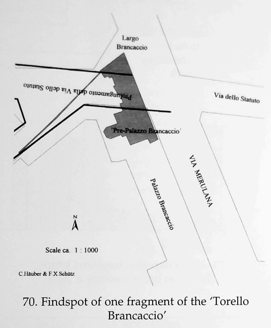
Findspot of one fragment of the Torello Brancaccio in Rome, Franz Xaver Schütz, Chrystina Häuber
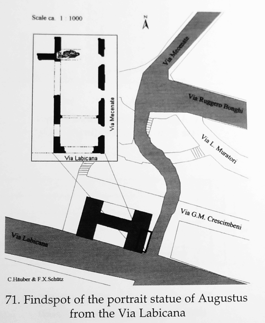
Findspot of the portrait statue of Augustus from the Via Labicana in Rome, Franz Xaver Schütz, Chrystina Häuber
Chrystina Häuber: Die wichtigsten Ergebnisse dieses Buches über Domitian = Deutsche Übersetzung von:
Chapter: The major results of this book on Domitian - Vorschau/Preview aus/from:
Chrystina Häuber (2021): The Cancelleria Reliefs and Domitian's Obelisk in Rome in context of the legitimation of Domitian's reign. With studies on Domitian's building
projects in Rome, his statue of Iuppiter Optimus Maximus Capitolinus, the colossal portrait of Hadrian (now Constantine the Great), and Hadrian's portrait
from Hierapydna. In Honour of Rose Mary Sheldon. FORTVNA PAPERS Volume III, edited by Franz Xaver Schütz and Chrystina Häuber, 2021.
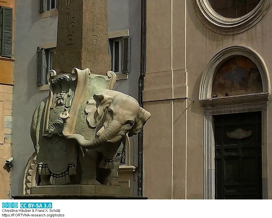
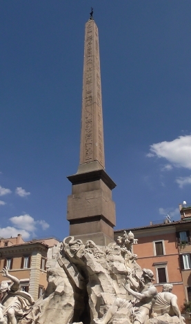
ROME, Ägyptischer Obelisk auf der Piazza della Minerva in Rom, Elefant, Bernini, Photo by Franz Xaver Schütz, Chrystina Häuber
THERMAE AGRIPPAE, Via dell'arco della Ciambella, ROMA, Rom, Rome, Photos by Chrystina HÄUBER, Franz Xaver SCHÜTZ
ROME, THERMAE AGRIPPAE, Via dell'arco della Ciambella, ROMA, Rom, Rome, Photos by Chrystina HÄUBER, Franz Xaver SCHÜTZ
ROME, Der Antinous-Obelisk in Rom, Photo by Franz Xaver SCHÜTZ, Chrystina HÄUBER
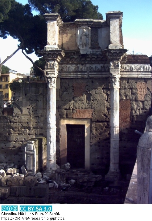
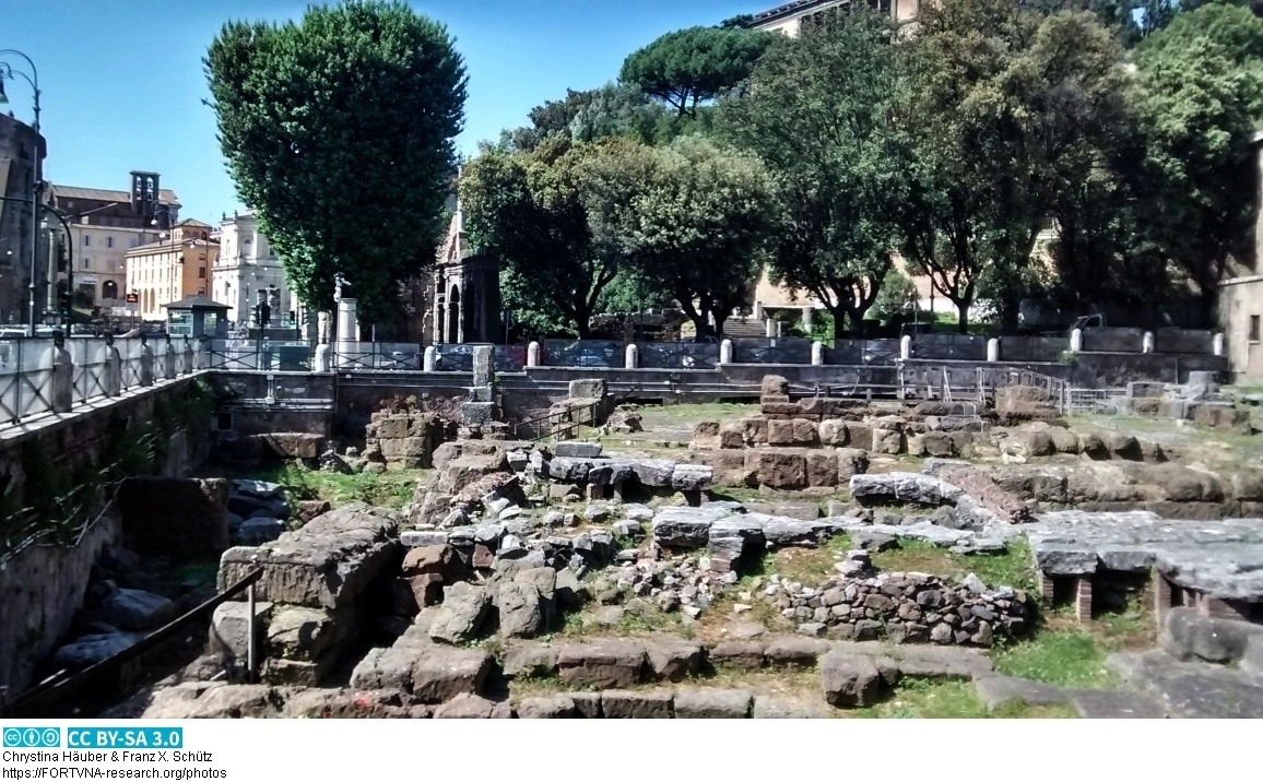
ROME, Area sacra di S. Omobono in Rom, Photo by Franz Xaver SCHÜTZ, Chrystina HÄUBER
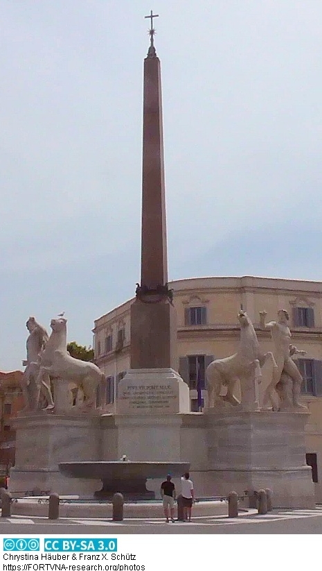
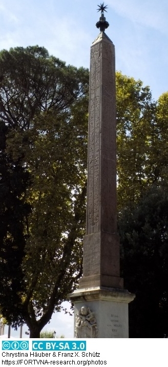
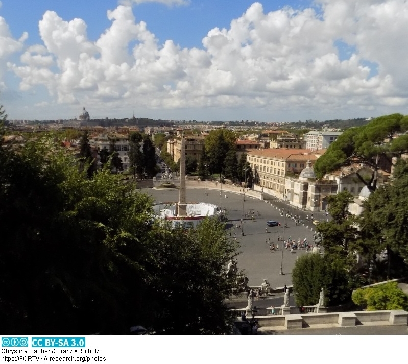
ROME, Ägyptischer Obelisk - Piazza del Popolo - Rom, Photo by Franz Xaver SCHÜTZ, Chrystina HÄUBER
ROME, Ägyptischer Obelisk - Piazza del Popolo - Rom, Photo by Franz Xaver SCHÜTZ, Chrystina HÄUBER
ROME, QUADRIFRONS FORUM BOARUM in Rom, Photo by Franz Xaver SCHÜTZ, Chrystina HÄUBER
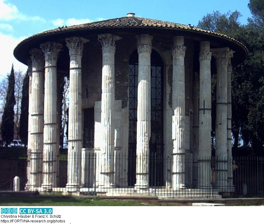
ROME, Rundtempel am Tiber in Rom, Photo by Franz Xaver SCHÜTZ, Chrystina HÄUBER
ROME, S. Giorgio in Velabro und ARCUS ARGENTARII in Rom, Photo by Franz Xaver SCHÜTZ, Chrystina HÄUBER
ROME, S. Giorgio in Velabro und ARCUS ARGENTARII in Rom, Photo by Franz Xaver SCHÜTZ, Chrystina HÄUBER
S. Giorgio in Velabro und ARCUS ARGENTARII in Rom, Photos: Franz Xaver SCHÜTZ and Chrystina HÄUBER
Area sacra di S. Omobono in Rom, Photos: Franz Xaver SCHÜTZ and Chrystina HÄUBER
QUADRIFRONS FORUM BOARIUM in Rom, Photos: Franz Xaver SCHÜTZ and Chrystina HÄUBER
Rundtempel am Tiber in Rom, Photos: Franz Xaver SCHÜTZ and Chrystina HÄUBER
Antinous-Obelisk in Rom, Photos: Franz Xaver SCHÜTZ and Chrystina HÄUBER
Ägyptischer Obelisk auf der Piazza del Popolo in Rom , Photos: Franz Xaver SCHÜTZ and Chrystina HÄUBER
Ägyptischer Obelisk auf der Piazza della Minerva in Rom, Photos: Franz Xaver SCHÜTZ and Chrystina HÄUBER
Der Obelisk des Domitian auf der Piazza Navona in Rom, Photos: Franz Xaver SCHÜTZ and Chrystina HÄUBER
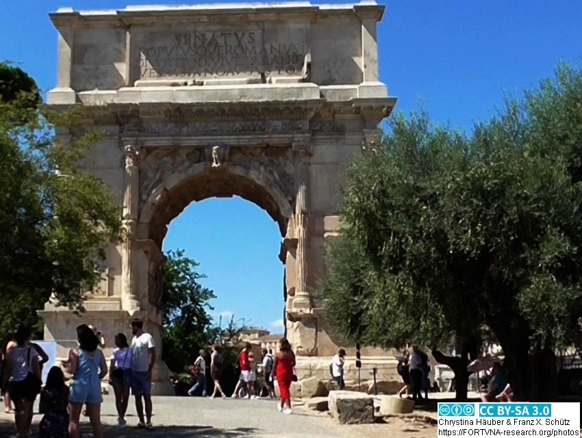
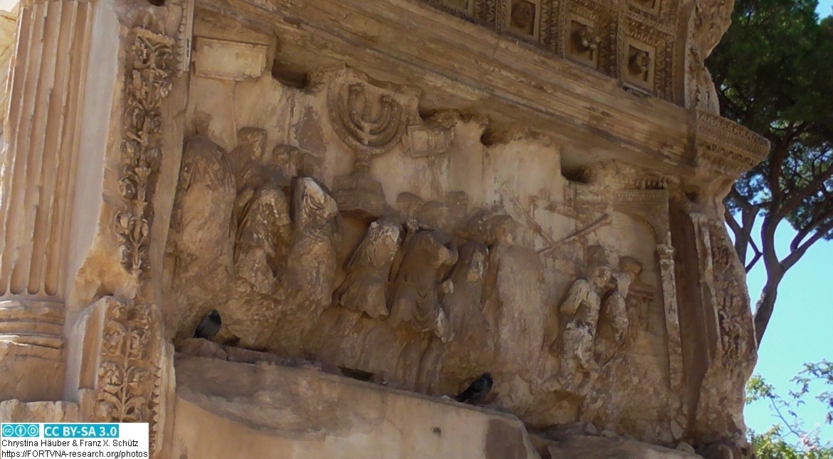
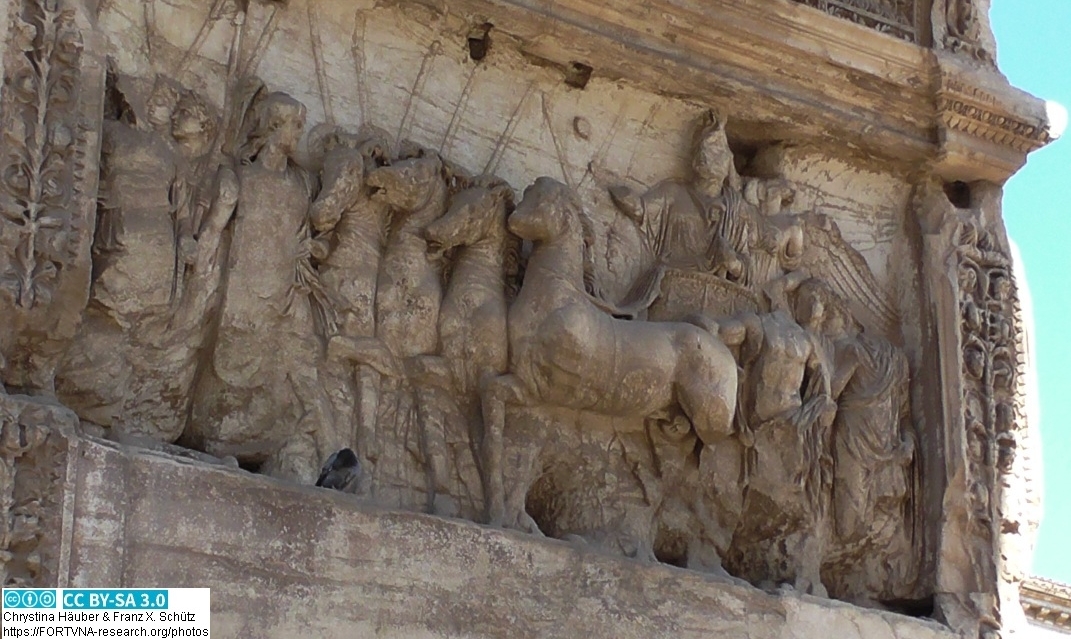
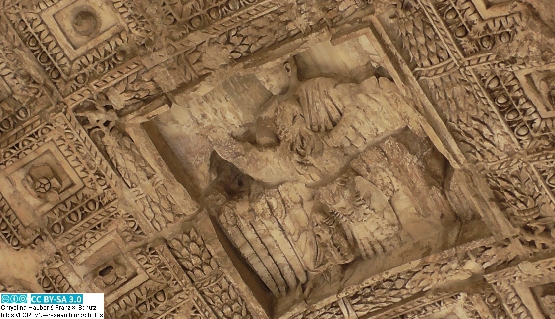
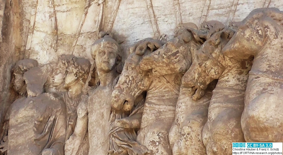
Photos Rom - Titusbogen / Images of Rome - Arch of Titus, Photos: Franz Xaver SCHÜTZ and Chrystina HÄUBER
Photos Rom / Images of Rome (and other locations), Franz Xaver SCHÜTZ and Chrystina HÄUBER
FORTVNA PAPERS 3, Chrystina Häuber,
Domitian, Palatin, Nollekens Relief, Titusbogen, Palatine, Rom, Rome, Arch of Titus
ROME, Arch of Titus, Rom, Titusbogen, Photo by Franz Xaver SCHÜTZ, Chrystina HÄUBER
ROME, Arch of Titus, Rom, Titusbogen, Photo by Franz Xaver SCHÜTZ, Chrystina HÄUBER
ROME, Arch of Titus, Rom, Titusbogen, Photo by Franz Xaver SCHÜTZ, Chrystina HÄUBER
ROME, Arch of Titus, Rom, Titusbogen, Photo by Franz Xaver SCHÜTZ, Chrystina HÄUBER
ROME, Arch of Titus, Rom, Titusbogen, Photo by Franz Xaver SCHÜTZ, Chrystina HÄUBER
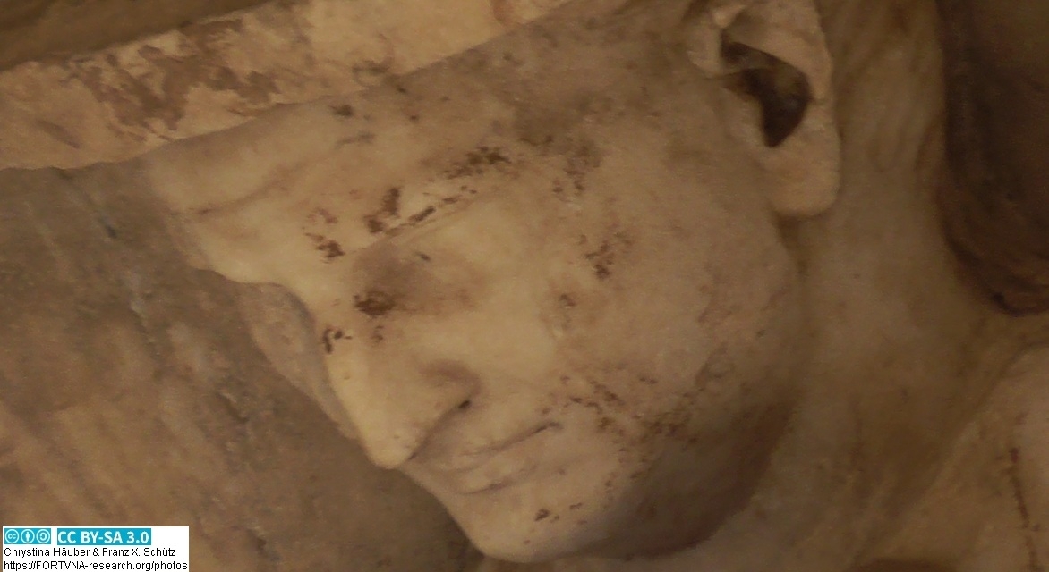
ROME, Arch of Titus, Rom, Titusbogen, Photo by Franz Xaver SCHÜTZ, Chrystina HÄUBER
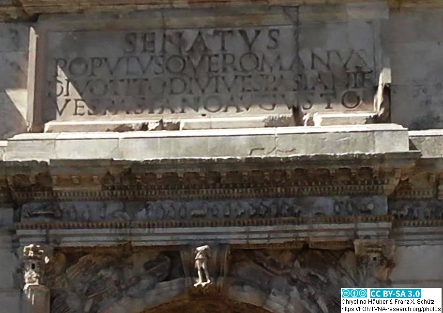
ROME, Arch of Titus, Rom, Titusbogen, Photo by Franz Xaver SCHÜTZ, Chrystina HÄUBER
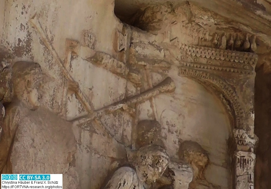
ROME, Arch of Titus, Rom, Titusbogen, Photo by Franz Xaver SCHÜTZ, Chrystina HÄUBER
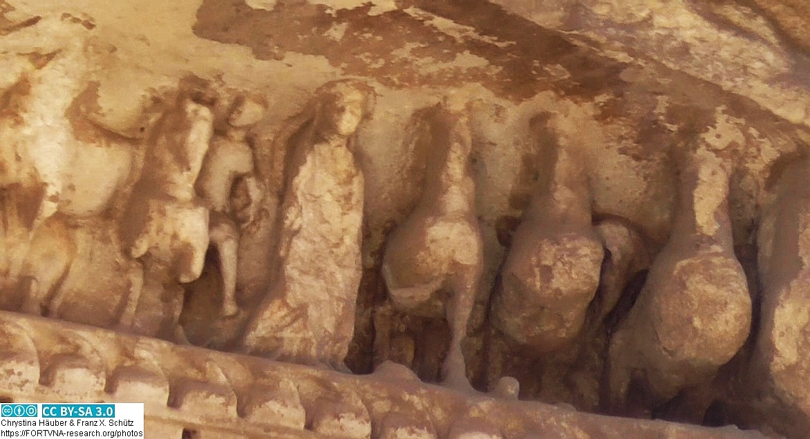
ROME, Arch of Titus, Rom, Titusbogen, Photo by Franz Xaver SCHÜTZ, Chrystina HÄUBER
FORTVNA PAPERS 3, Chrystina Häuber,
Chapter: The major results of this book on Domitian - version 25.1.2023
ROME, Obeliscus Pamphilius/ Domitian's Obelisk, Photo by Franz Xaver SCHÜTZ, Chrystina HÄUBER
ROME, Column of TRAJAN, Basilica ULPIA, Trajanssäule, Basilika ULPIA, Rom, Photo by Franz Xaver SCHÜTZ, Chrystina HÄUBER
FORTVNA PAPERS 3, Chrystina Häuber,
Chapter: The visualization of the results of this book on Domitian on our maps (`Die Visualisierung der Resultate dieses Buches über Domitian auf unseren Karten´) mit
zwei georeferenzierten Karten des Marsfeldes in Rom zur Kaiserzeit
Georeferenzierte Karte Marsfeld Rom, CAMPUS MARTIUS, Chrystina HÄUBER, Franz Xaver SCHÜTZ
Georeferenzierte Karte Marsfeld Rom, CAMPUS MARTIUS, Chrystina HÄUBER, Franz Xaver SCHÜTZ
Georeferenzierte Karte Marsfeld Rom, CAMPUS MARTIUS, Chrystina HÄUBER, Franz Xaver SCHÜTZ
Georeferenzierte Karte Marsfeld Rom, CAMPUS MARTIUS, Chrystina HÄUBER, Franz Xaver SCHÜTZ
Georeferenzierte Karte Marsfeld Rom, CAMPUS MARTIUS, Chrystina HÄUBER, Franz Xaver SCHÜTZ
Georeferenzierte Karte Marsfeld Rom, CAMPUS MARTIUS, Chrystina HÄUBER, Franz Xaver SCHÜTZ
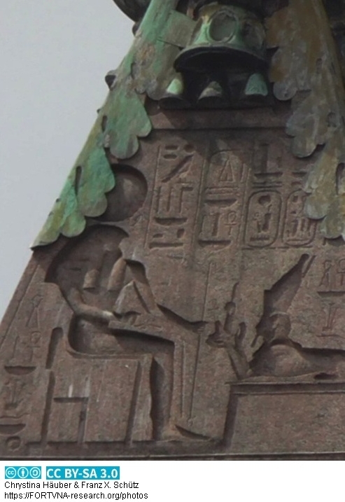
Fig. 28. Obeliscus Pamphilius/ Domitian's Obelisk. From the Iseum Campense. On display on top of Gianlorenzo Bernini's `Fountain of the Four Rivers´ in the
Piazza Navona at Rome / Der Obeliscus Pamphilius/ der Obelisk Domitians. Aus dem Iseum Campense. Er befindet sich auf Gianlorenzo Berninis Vierströmebrunnen
auf der Piazza Navona in Rome (Photo: F.X. Schütz 5. September 2019). Vorschau/Preview aus/from: Chrystina Häuber (2021): The Cancelleria Reliefs and Domitian's
Obelisk in Rome in context of the legitimation of Domitian's reign. With studies on Domitian's building projects in Rome, his statue of Iuppiter Optimus Maximus
Capitolinus, the colossal portrait of Hadrian (now Constantine the Great), and Hadrian's portrait from Hierapydna.
In Honour of Rose Mary Sheldon. With Contributions by John Bodel, Emanuele M. Ciampini, Amanda Claridge, Angelo Geißen, Laura Gigli, Hans Rupprecht Goette,
Peter Herz, Eugenio La Rocca, Eric M. Moormann, Jörg Rüpke, Franz X. Schütz, R.R.R. Smith, Giandomenico Spinola, Mario Torelli, Walter Trillmich, Claudia Valeri,
and T.P. Wiseman.
FORTVNA PAPERS, edited by Franz Xaver Schütz and Chrystina Häuber, Volume III, 2021.
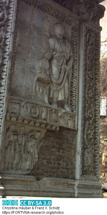
Cancelleria Reliefs (Photo: F.X. Schütz 3/2006) , Vorschau/Preview aus/from: Chrystina Häuber (2021): The Cancelleria Reliefs and Domitian's
Obelisk in Rome in context of the legitimation of Domitian's reign. With studies on Domitian's building projects in Rome, his statue of Iuppiter Optimus Maximus
Capitolinus, the colossal portrait of Hadrian (now Constantine the Great), and Hadrian's portrait from Hierapydna.
In Honour of Rose Mary Sheldon. With Contributions by John Bodel, Emanuele M. Ciampini, Amanda Claridge, Angelo Geißen, Laura Gigli, Hans Rupprecht Goette,
Peter Herz, Eugenio La Rocca, Eric M. Moormann, Jörg Rüpke, Franz X. Schütz, R.R.R. Smith, Giandomenico Spinola, Mario Torelli, Walter Trillmich, Claudia Valeri,
and T.P. Wiseman.
FORTVNA PAPERS, edited by Franz Xaver Schütz and Chrystina Häuber, Volume III, 2021.
What this study is all about, Vorschau/Preview aus/from: Chrystina Häuber (2021): The Cancelleria Reliefs and Domitian's
Obelisk in Rome in context of the legitimation of Domitian's reign. With studies on Domitian's building projects in Rome, his statue of Iuppiter Optimus Maximus
Capitolinus, the colossal portrait of Hadrian (now Constantine the Great), and Hadrian's portrait from Hierapydna.
In Honour of Rose Mary Sheldon. With Contributions by John Bodel, Emanuele M. Ciampini, Amanda Claridge, Angelo Geißen, Laura Gigli, Hans Rupprecht Goette,
Peter Herz, Eugenio La Rocca, Eric M. Moormann, Jörg Rüpke, Franz X. Schütz, R.R.R. Smith, Giandomenico Spinola, Mario Torelli, Walter Trillmich, Claudia Valeri,
and T.P. Wiseman.
FORTVNA PAPERS, edited by Franz Xaver Schütz and Chrystina Häuber, Volume III, 2021.
Chrystina HÄUBER, List of papers read, Liste der Vorträge
Chrystina HÄUBER, List of publications, Liste der Publikationen
HÄUBER Chrystina, SCHÜTZ Franz Xaver (1997): FORTVNA (F ormulating outlines of a geO graphic R ome data bank:
T exts, V isual and computer- N etworks in A rchaeology). EIN MULTIMEDIALES GEOGRAPHISCH-ARCHÄOLOGISCHES INFORMATIONSSYSTEM GIS[A]
AM BEISPIEL DER ADELSPALÄSTE IM ANTIKEN ROM. ERSTE ANWENDUNGSBEISPIELE. In: EVA '97 Berlin. Konferenzband Elektronische Bildverarbeitung &
Kunst, Kultur, Historie. 12.-14. November 1997. V10. Ohne Paginierung.
Chrystina HÄUBER (2014): Rome: the city of memories. Or, why and how reconstruct and visualize ancient and post-antique Rome using digital technologies?
The AIS ROMA, diachronic and phase maps of (ancient) Rome in the WWW - Short Version*. In: BWM 6, 2014, Seiten 48-67. ISBN 978-3-931349-41-7.
Chrystina HÄUBER, Franz Xaver SCHÜTZ (2010): The Sanctuary Isis et Serapis in Regio III in Rome: Preliminary Reconstruction and Visualization of the ancient Landscape
using 3/4D-GIS-Technology. In: Bollettino di Archeologia on line I 2010/ Volume speciale D / D3 / 7. XVII International Congress of Classical Archaeology,
Roma 22-26 Sept. 2008, Session: Oriental Cults of Rome. Reg. Tribunale Roma 05.08.2010 n. 330 ISSN 2039 - 0076, pp. 82-94
publication: Franz Xaver SCHÜTZ, Chrystina HÄUBER, 2001, Reconstructing Ancient Rome, using Remote Sensing and GIS-technology:
The Archaeological Information System FORTVNA. In: JÜRGENS, Carsten (2001) (Editor): Remote Sensing of Urban Areas/ Fernerkundung in urbanen Räumen.
(= Regensburger Geographische Schriften, Heft 35). Regensburg. ISBN 3-88246-222-1, Seiten 283-294
Ergänzungen zu unserem Aufsatz Franz Xaver Schütz und Chrystina Häuber 2001 mit dem Titel: Chrystina HÄUBER, Franz Xaver SCHÜTZ 2022:
The fragmentary cult-statues of the sanctuaryIsis et Serapis inRegio III /
Die fragmentarischen Kultstatuen des Heiligtums Isis et Serapis der Regio III
======================================================================================================
Franz Xaver Schütz, Chrystina HÄUBER 2003, CREATING PRECISE ARCHAEOLOGICAL MAPS FOR THE CITY OF ROME: THE ADVANTAGE OF THE USAGE OF PHOTOGRAMMETRIC DATA
OVER "PAPER BASED" METHODS. In: 4th International Symposium Remote Sensing of Urban Areas, Regensburg, Germany, 27-29 June, 2003, The International Archives
of the Photogrammetry, Remote Sensing and Spatial Information Sciences (ISPRS) (CD-ROM), vol. XXXIV-7/W9, 170-175.
Map 3 aus HÄUBER 2014 mit Georeferzenzierungsdatei, Franz Xaver Schütz, Chrystina Häuber
Campus Martius, Imperial period, with adjacent quarters of the City. In: FORTVNA PAPERS II, 2017, Chrystina Häuber, p. 63, Fig. 3.5
Campus Martius, Augustan period, with adjacent areas. In: FORTVNA PAPERS II, 2017, Chrystina Häuber,
p. 69, Fig. 3.7, Franz Xaver Schütz, Chrystina Häuber
Detail of Fig. 3.7. Campus Martius, Augustan period, with adjacent areas with the photogrammetric
data on top of the drawings. In: FORTVNA PAPERS II, 2017, Chrystina Häuber, p. 71, Fig. 3.7.1, Franz Xaver Schütz, Chrystina Häuber
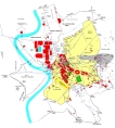
Georeferenzierte Karte des antiken Rom mit Stadtmauern
(HTML), Franz Xaver Schütz, Chrystina Häuber
Karte Rom Mausoleum des Augustus Montectorio Obelisk Ara Pacis MARSFELD
/ map city of Rome Mausoleum Augusti Ara Pacis Campus Martius (HTML), Franz Xaver Schütz, Chrystina Häuber
Georeferenzierte Karte Rom, Kapitol und Palatin / georeferenced map City of Rome
Capitoline Hill, Palatin (HTML), Franz Xaver Schütz, Chrystina Häuber
Georeferenzierte Karte Rom, Via Appia, Porta Capena / georeferenced map
City of Rome Via Appia, Porta Capena (HTML), Franz Xaver Schütz, Chrystina Häuber
------------------------------------------
Große Karte des Marsfeldes Rom / georeferenced map
City of Rome, Great map of Campus Martius (HTML), Franz Xaver Schütz, Chrystina Häuber
----------------------------------------------------
-------------------------------------------------------
index of publications on this webserver
publication, C HÄUBER, 1991 , Horti Romani. Die Horti Maecenatis und die Horti Lamiani auf dem Esquilin. Geschichte,
Topographie, Statuenfunde (Diss. Köln 1986) Köln 1991
publication, C HÄUBER, 2005 , Das Archäologische Informationssystem `AIS ROMA´:
Esquilin, Caelius, Capitolium, Velabrum, Porta Triumphalis, BullCom 106, 2005, S. 9-59. / Franz Xaver Schütz, Chrystina Häuber
C HÄUBER 2013 , Archäologische Stadtforschung, publication
publication, FX Schütz, 2008, Zum Regensburger und Kölner Stadtgrundriss.
Eine GIS-gestützte Untersuchung, publication
Chrystina Häuber 2014 Bibliography
FX Schütz, 2014, Why work with geographers in reconstructions and visualizations of ancient Rome? An application of the landscape(t)-model, pubication
C HÄUBER, 2022, Die Laokoongruppe im Vatikan - drei Männer und zwei Schlangen: `Ich weiß gar nicht, warum die sich so aufregen´ (Wolfgang Böhme) - die Bestätigung von F. Magis Restaurierung der Gruppe und der Behauptungen, sie sei für die Horti des Maecenas, später Domus Titi, geschaffen, und dort entdeckt worden. FORTVNA PAPERS, Eds. Franz Xaver Schütz and Chrystina Häuber, Volume IV, München: Hochschule München. Preview/Vorschau, publication
C HÄUBER, 2022, Die Laokoongruppe im Vatikan - drei Männer und zwei Schlangen: `Ich weiß gar nicht, warum die sich so aufregen´ (Wolfgang Böhme) - die Bestätigung von F. Magis Restaurierung der Gruppe und der Behauptungen, sie sei für die Horti des Maecenas, später Domus Titi, geschaffen, und dort entdeckt worden. FORTVNA PAPERS, Eds. Franz Xaver Schütz and Chrystina Häuber, Volume IV, München: Hochschule München. Preview/Vorschau, publication.
publication, C HÄUBER, 2022, Die Laokoongruppe im Vatikan - drei Männer und zwei Schlangen:
`Ich weiß gar nicht, warum die sich so aufregen´ (Wolfgang Böhme) - die Bestätigung von F. Magis Restaurierung der Gruppe und der Behauptungen, sie sei für die Horti
des Maecenas, später Domus Titi, geschaffen, und dort entdeckt worden. FORTVNA PAPERS, Eds. Franz Xaver Schütz and Chrystina Häuber, Volume IV, München: Hochschule
München. Preview/Vorschau, Franz Xaver Schütz, Chrystina Häuber
SCHÜTZ 2004, 2022: Was ist ein Informationssystem?
SCHÜTZ 2004, 2022: Die historische Entwicklung von Informationssystemen
SCHÜTZ 2004, 2022: Welche Archäologie?
SCHÜTZ 2004, 2022: Definition eines Archäologischen Informationssystems
SCHÜTZ 2004, 2022: Historische Entwicklung von
Archäologischen Informationssystemen
SCHÜTZ 2004, 2022:
Literatur zu Archäologischen Informationssystemen Teil 1, bis 2003, A bis G
SCHÜTZ 2004, 2022:
Literatur zu Archäologischen Informationssystemen Teil 2, bis 2003, H bis Z
SCHÜTZ 2004, 2022:
Mögliche Komponenten eines Archäologischen Informationssystems, Menschen, Daten und Informationen, Datentypen und Datenformate, Textdaten, Franz Xaver Schütz, Chrystina Häuber
SCHÜTZ 2017:
Von Meridianen, Koordinatensystemen, Nordpfeilen und deren Relevanz für räumlich-temporale Modellierungen mit dem Archäologischen Informationssystem AIS ROMA,
in FORTVNA PAPERS Volume II, Franz Xaver Schütz, Chrystina Häuber
Publication, HÄUBER C, 2017, Bibliography, FORTVNA PAPERS Volume 2, Franz Xaver Schütz, Chrystina Häuber
Publication, GeoApp-Entwicklung (Geoinformatik III) Sommersemester 2020 - Autor: Franz Xaver Schütz - 2. Lehrbrief vom 8.4.2020
Publication, GeoApp-Entwicklung (Geoinformatik III) Sommersemester 2020 - Autor: Franz Xaver Schütz - 3. Lehrbrief vom 30.4.2020/3.5.2020
Die Karte von C. Häuber (2014, Map 3), korrigiert und erweitert; im Buch von C. Häuber über Domitian, FORTVNA PAPERS III, heißt diese Karte `Fig. 71´.
C HÄUBER (2022): Romkarte/Map of Rome, MUNDUS, FORUM ROMANUM, COLLIS QUIRINALIS, COLLIS VIMINALIS, MONS OPPIUS, ESQUILINUS, MONS CAELIUS, LUCUS FAGUTALIS
Geoinformationssysteme (GIS GD43) Sommersemester 2020 - Autor: Franz Xaver Schütz, 2. Lehrbrief vom 5.4.2020
mappe georeferenziate della topografia e della storia della città di Roma / georeferenzierte Karten zur Topographie und Geschichte der Stadt Rom /
georeferenced maps of the coty of Rome on topography and history / ローマ市の地形と歴史のジオリファレンスされた地図 / Franz Xaver Schütz, Chrystina Häuber
Datenschutzerklärung | Impressum
30.7.2026